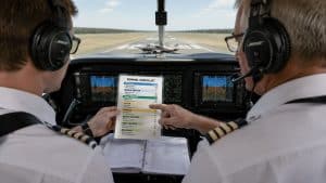
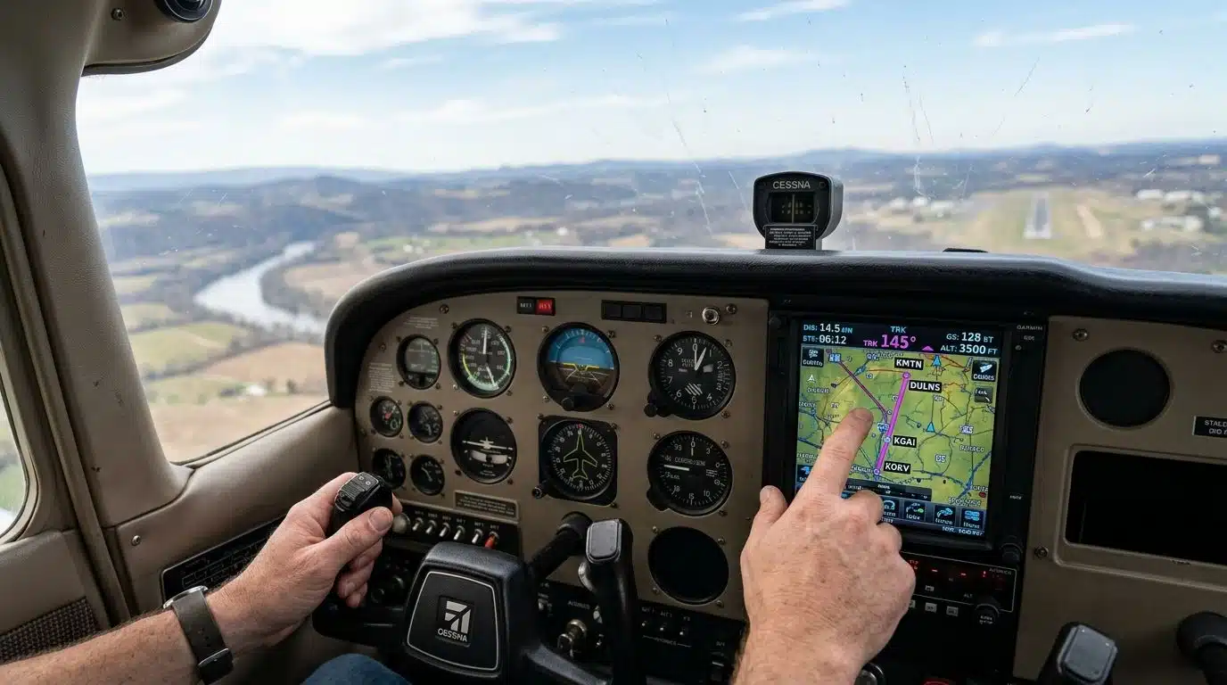
You've got the GPS loaded, the airport's in sight, and the magenta line looks calm. Then ATC gives you a reroute, the CDI sensitivity changes, and the student beside you asks whether the waypoint really matches the plate. That's the exact moment gps navigation training stops being a box to check and starts becoming a skill that keeps a flight organized, legal, and calm.
The good news is that GPS work in small aircraft isn't mysterious. It's a mix of system knowledge, cockpit discipline, and the habit of verifying what the screen says before you trust it. The pilots who stay ahead of the airplane usually aren't the ones who know the most buttons, they're the ones who know when to slow down, cross-check, and switch to backup thinking.
Two practical options worth comparing
These are specific products pilots commonly compare for this type of flying. Confirm compatibility with your aircraft and instructor before ordering.
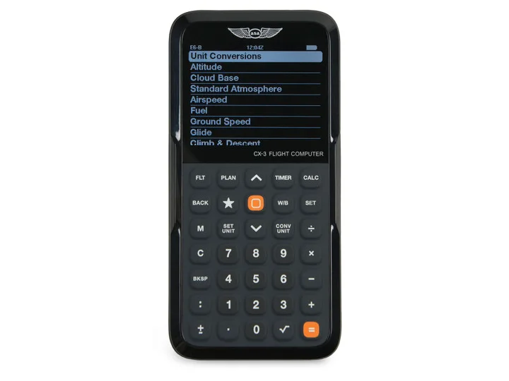 Flight planningASA CX-3 Flight ComputerCheck current availability on Amazon (paid link)
 Electronic flight bagApple iPad mini A17 Pro, Wi-Fi and Cellular, 128GBCheck current availability on Amazon (paid link)
Table of Contents
- Understanding Key GPS Concepts
- Cockpit Setup and Navigation Panel Procedures
- Flight Planning and Database Management
- Simulated GPS Navigation Drills
- In-Air GPS Practice and RNAV Approach Technique
- Common Problems and How to Fix Them
- Structured Lesson Plan Milestones and Additional Resources
Understanding Key GPS Concepts
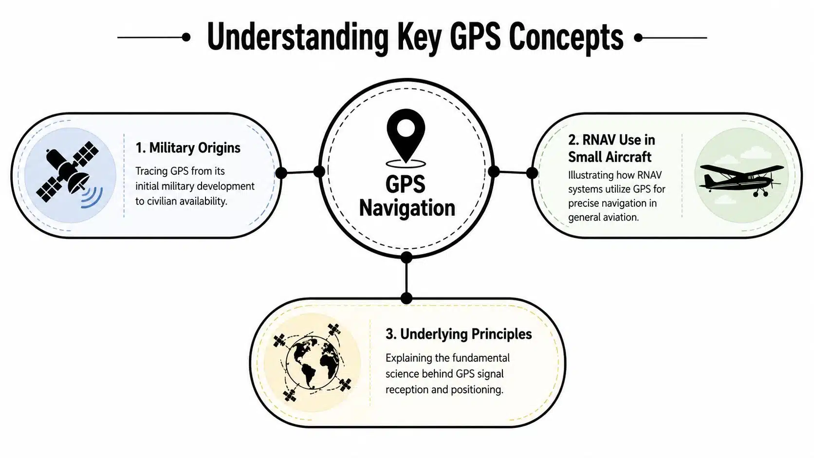
GPS started as a military satellite-navigation program, not as a cockpit convenience. The U.S. Department of Defense formally began the project in 1973, building on earlier systems such as Transit, whose first satellite launched in 1960 and became the world's first global satellite navigation system (A Brief History of GPS). By 1993, the full 24-satellite constellation was operational, which made worldwide positioning practical for aviation and other users. By 2000, the end of Selective Availability sharply improved civilian accuracy from roughly 100 meters to about 2 meters in favorable conditions.
That history matters in training because modern RNAV work depends on geometry, database quality, and disciplined pilot technique. GPS is satellite-based positioning, but the box only stays useful when the pilot manages waypoint order, route changes, and cross-checks with care. In a small airplane, the moving map supports the flight, it does not replace pilotage or dead reckoning.
Why the old and the new belong together
A lot of new pilots start by memorizing menus, then miss the larger picture. The first habit I teach is simple, confirm the route with a second reference before departure, then keep checking it in flight. That same habit shows up in a good guide on using GPS in rugged terrain, where the map, the compass, and the environment all need to agree before you keep going.
Practical rule: if the waypoint sequence, the terrain picture, and the chart do not line up, stop and sort it out on the ground.
For DuBois Aviation students who want a clearer picture of how avionics fit together, the flight management systems overview helps connect GPS logic to route loading, navigation-source selection, and aircraft management. It gives the cockpit workflow a broader frame without turning the training into theory for theory's sake.
The main point is straightforward. GPS works best when it sits inside a larger navigation picture. That keeps the pilot from getting lazy, and it makes the system more useful when the workload rises.
Cockpit Setup and Navigation Panel Procedures
A clean GPS flight starts before engine start. If the cockpit setup is sloppy, every later decision gets harder, because you'll be fixing basic configuration mistakes when you should be flying. In the training aircraft, I like to slow students down long enough to get the unit, the CDI source, and the autopilot relationship sorted out before taxi.
Start with the source, not the screen
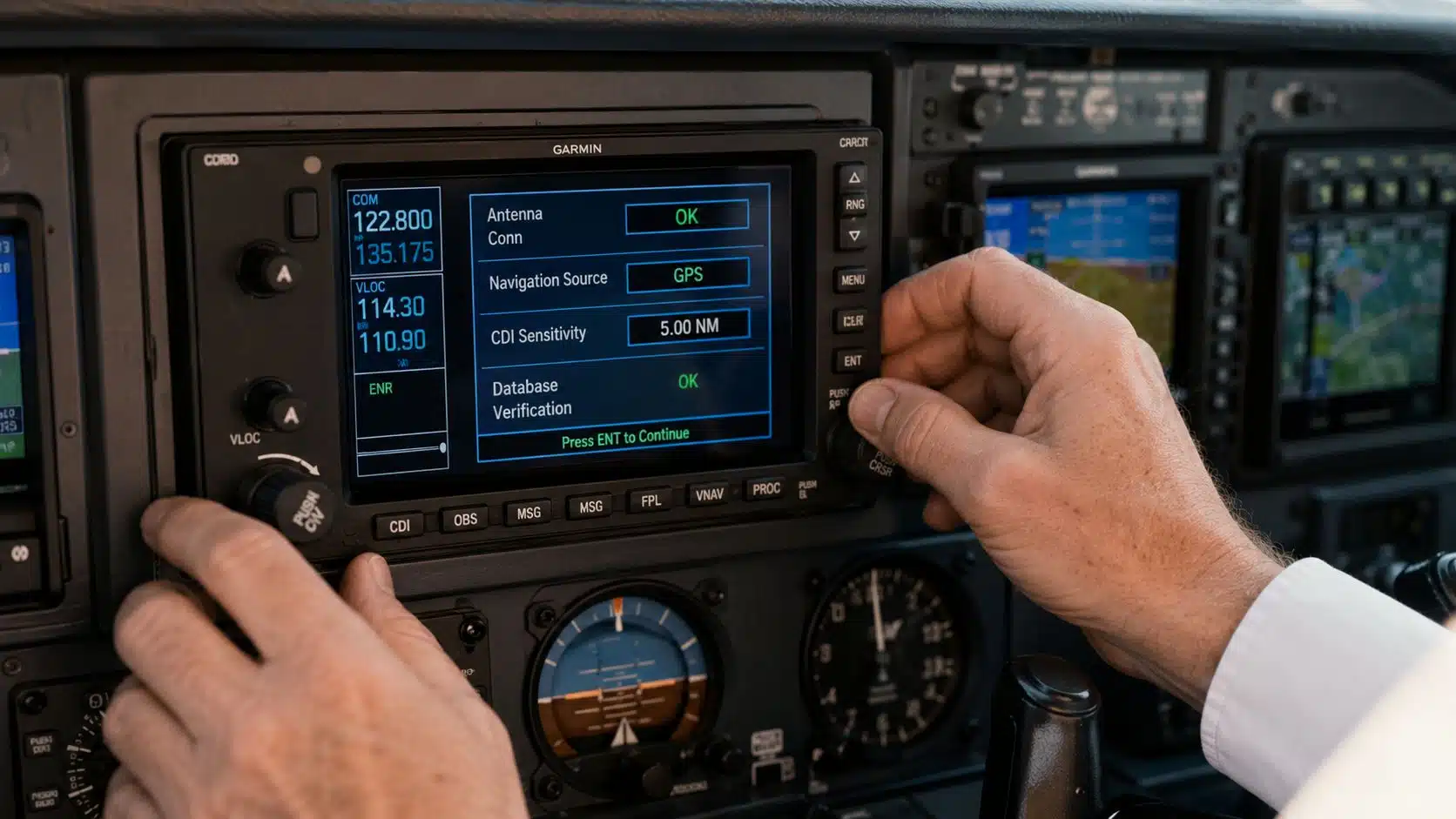
The first question is always, what is driving the needle right now. On Garmin 430 and 530 setups, that means confirming whether the CDI is set to GPS or VLOC before takeoff, because the wrong source can make a perfect route look wrong. When the aircraft is coupled to an autopilot, source discipline matters even more, since the autopilot will faithfully follow whatever the navigator is telling it.
A good startup flow usually looks like this:
- Power up and let the unit stabilize. Don't rush the boot sequence or skip the alert messages.
- Check database status. If the navigation data are expired or mismatched, fix that before flight.
- Verify antenna and signal reception. If the unit is acting oddly on the ramp, don't assume it'll sort itself out later.
- Set the correct CDI source. GPS for GPS legs, VOR/LOC when the procedure calls for it.
- Match the autopilot mode to the navigation source. A mode mismatch can create a very confident mistake.
Keep the setup boring. Boring cockpit setup is usually excellent cockpit setup.
For training flights around KCNO, that discipline prevents one of the most common student habits, letting the display drive the flight instead of making the display serve the flight. The screen should confirm what you already know from the briefing, not replace it.
Build the backup habit on the ground
Backup switching should be practiced, not improvised. If the route calls for VOR or LOC support, make the transition deliberately and verbalize it. If a student can say out loud, “GPS is primary, VLOC is armed, and the approach source matches the plate,” there's a good chance the cockpit is organized correctly.
That same mindset carries into mixed avionics and instruction setups. One option at KCNO is DuBois Aviation itself, because the school's one-on-one training model makes it easier to slow down and verify source selection without pressure from a crowded checkout schedule. The point isn't brand loyalty, it's building a repeatable cockpit routine that survives workload.
Flight Planning and Database Management
A GPS route is only as reliable as the data behind it. That's why flight planning starts with the database, the charts, and the actual route logic, not with finger-tapping waypoints into a screen. The pilot who loads a route from memory but never checks the data cycle is gambling with someone else's procedure.
A KCNO to KSAN planning workflow
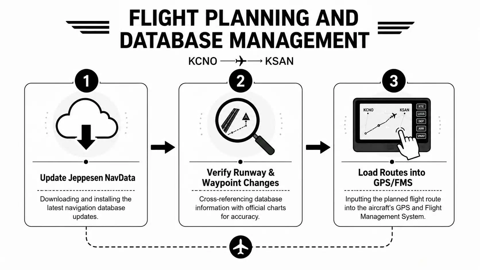
For a Chino to San Diego cross-country, I want the student to treat route planning like a chain of verification. Update the navigation database first, then compare runway and waypoint information against the chart, then load the route into both the GPS and the backup planning tool. If the route doesn't match the plate, the plate wins until the discrepancy is understood.
Skybrary's guidance is blunt about the right habit here, it emphasizes independent waypoint verification and continuous monitoring rather than blind reliance on the moving map (Skybrary guidance on unreliable GPS). That's exactly how I want students to think. The unit may be accurate, but the pilot still owns the responsibility to confirm every critical fix.
A practical preflight sequence looks like this:
- Update the nav data first. Old data create old mistakes.
- Cross-check every inserted waypoint. Misspelled fixes and duplicates are common student errors.
- Check the departure, en route, and approach plates. The route has to make sense across all three phases.
- Load the same route into the backup tool. That makes a mismatch easier to spot.
- Review ATC constraints before taxi. A route that's legal on the screen still has to fit the clearance.
The main win here is not fast entry, it's consistency. When the student sees the same fix names in the GPS, on the paper chart, and on the approach plate, confidence goes up and workload goes down.
Don't confuse convenience with accuracy
The screen can make route entry feel effortless, which is exactly why errors slip through. Duplicate waypoints, expired cycles, and missed procedure changes are easier to catch on the ground than in the air. Once the airplane is moving, your attention belongs outside and ahead, not buried in a data-entry correction.
That's why I want the planning process to end with one final verbal check. If the route, the database, and the chart agree, then the airplane is ready. If they don't, delay the flight and fix the mismatch.
Simulated GPS Navigation Drills
A simulator is where GPS training gets honest. You can create workload, make mistakes, and reset the drill without burning fuel or turning a simple error into a bad day. The FAA FITS study favored scenario-based GPS training over conventional instruction, with fewer omission and incorrect-use errors on flight evaluations (FAA FITS GPS study).
Four drills that matter in the real cockpit
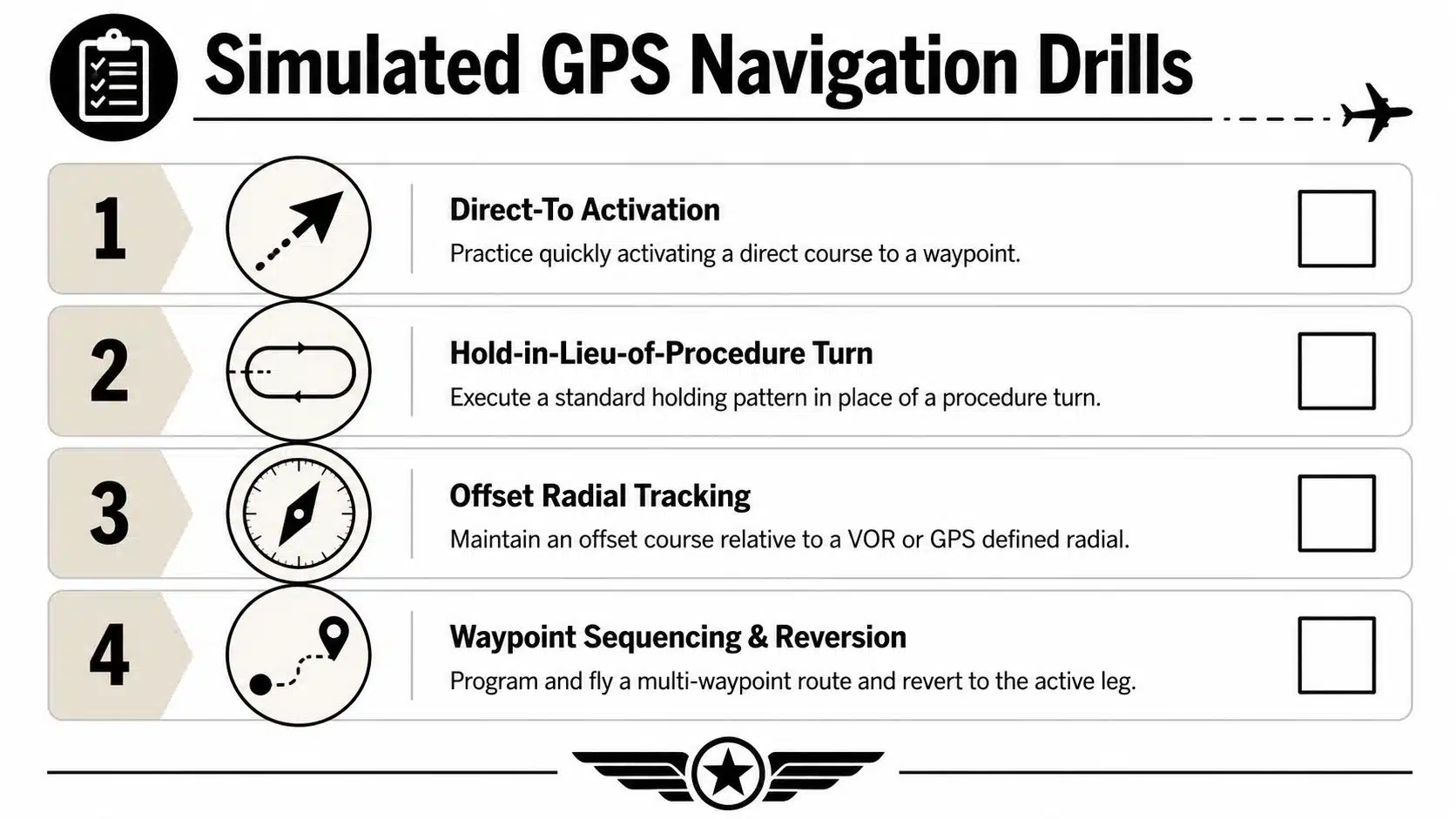
The first drill is Direct-To activation. I want the student to select a waypoint, confirm the course, and activate it without hunting through menus. The learning objective is speed with verification, not button-mashing.
The second is a hold-in-lieu-of-procedure turn. This forces the pilot to respect procedure structure instead of assuming every approach leg is a simple straight line. It also exposes whether the student understands where the airplane should be, not just what the screen says.
The third drill is offset radial tracking. This one matters because it teaches situational thinking around course deviation, not just following the magenta line. It's a solid test of instrument scan, heading control, and mental picture.
The fourth is a partial GPS outage scenario. That lesson should be handled like a real cockpit event, because a pilot has to decide when to continue, when to revert, and when to simplify. The point is not to stare at the display and hope the signal returns, it is to keep flying, confirm the source of the problem, and move to a safer setup before workload climbs.
Instructor's habit: if the failure is simulated, the pilot should still act like it's real until the drill is complete.
What success looks like
Success isn't just staying on the line. It's recognizing the failure, confirming the source, and using the backup picture without freezing. That is why I like debriefing each drill with three questions, what went wrong, what did you verify, and what would you do if the same issue happened outside the simulator?
For students who want a dedicated place to practice, the simulator training center gives you a controlled setting to repeat these workflows until they are automatic. If you are arranging a larger group event or a one-off training day, corporate event simulator options can also be useful for structured practice. The point is the same in every setting, repeat the scenario until your response is calm and deliberate.
In-Air GPS Practice and RNAV Approach Technique
A student can look smooth in the simulator and still get rattled in the airplane. Real airspace adds spacing, wind, ATC calls, and the pressure of keeping the setup clean while everything moves at once. The better approach flights are the ones where the pilot already knows the sequence and can spend attention on flying the airplane instead of decoding the display.
Fly the approach like a checklist, not a guess
Before intercepting the final approach course, I want the pilot to brief the inbound course, confirm the waypoint sequence, and set the correct navigation source. If the autopilot is in use, it has to be coupled in the mode that matches the procedure. If the airplane is being hand-flown, the work should stay coordinated, steady, and free of unnecessary corrections.
During the approach, the scan cannot go static. CDI movement, altitude discipline, and timing all matter, and the pilot should be ready to use localizer-based guidance if the procedure or equipment calls for it. The goal is to keep the airplane stable and follow the procedure correctly, not to stare at the magenta line and hope it tells the full story.
A study on INS/GPS integration found that during a 30-second simulated GPS outage, the system could hold position error near 20 meters in the tested setup. In practical training terms, that is a reminder that continuity matters, and so does knowing how to keep flying when the navigation picture starts to degrade.
If GPS guidance gets shaky, the pilot should simplify the workload and keep flying.
The trade-off is straightforward. More automation can reduce workload, but it also gives the pilot less practice managing the approach by reference to raw data and backup cues. That is why I want students to keep their hands and eyes engaged, even when the avionics are doing most of the guidance.
Make the missed approach part of the plan
The missed approach belongs in the briefing, not as an afterthought. Students do better when they treat it as a normal possibility and know the first heading, the first altitude, and the source transition before the approach starts.
Cross-checking with instrument approach procedures keeps that briefing tied to the actual plate instead of memory. That matters most when the airplane is close to minimums or when a small source-selection mistake could turn a stable setup into a messy one.
In training at KCNO, I like to tie the approach briefing to a clear milestone. The student should be able to explain the setup, fly the path, and brief the missed without guessing. Once that starts happening consistently, the lesson count is doing its job, because the pilot is no longer reacting to each step as a surprise.
Common Problems and How to Fix Them
Most GPS mistakes are not dramatic. They start as small slips, then turn into extra workload when the pilot has to sort them out late in the flight. Catch a waypoint mismatch on the ground, and the flight stays ordinary. Catch it on final approach, and the whole cockpit feels tighter.
The errors that keep repeating
Wrong waypoint entry usually comes from rushing. The student sees a similar fix name, assumes it is correct, and keeps moving. The fix is plain, read the full waypoint, compare it to the chart, and verify the sequencing before the airplane leaves the ground.
Skipped database updates create a different kind of problem. The route may look correct, while the procedure in the navigator no longer matches the chart in front of the pilot. That mismatch matters most on approaches, where the navigator and the published procedure have to agree exactly.
Over-trusting the magenta line is a mindset error. The screen can look precise while still pulling the pilot toward a poor decision. The better habit is to pair GPS guidance with visual landmarks, headings, and the other navigation tools already in the cockpit.
The less obvious trap
Studies link over-dependence on GPS to impaired spatial memory and weaker route knowledge, which means pilots can spend more time watching details while losing the bigger picture (GPS dependence and spatial memory study). That's a tangible trade-off, not a theory problem. If the device does all the thinking, the pilot's mental map gets thinner.
The same research also points to route planning and position tracking as factors that can worsen route and survey learning. The prevention strategy is straightforward, keep talking through the route, name landmarks, and force yourself to predict what should happen next before the GPS shows it.
Debrief question: did the pilot understand the flight path, or just follow the display?
The habit I want is simple. Cross-check the screen, name the landmarks, confirm the source, and then make the next decision. That keeps GPS in its proper place as a tool, not a crutch.
Structured Lesson Plan Milestones and Additional Resources
A solid GPS curriculum should build in layers. At DuBois Aviation, I'd want the student to move through basic menu navigation, direct-to procedures, RNAV approaches, partial failures, cross-country integration, emergency reversion, and solo validation in that general order. The sequencing matters because each lesson reduces one layer of uncertainty before the next one is added.
A practical seven-lesson progression
Here's a workable structure for a private or instrument student at KCNO:
- Basic menu navigation. Learn the unit without flight pressure.
- Direct-to procedures. Make route changes quickly and verify them.
- RNAV approaches. Fly published procedures with correct source selection.
- Partial failures. Handle degraded GPS or confusing indications.
- Cross-country integration. Load, brief, and fly a full route.
- Emergency reversion. Practice raw-data or alternate navigation.
- Solo validation. Demonstrate the same workflow without coaching.
The milestone isn't just completion, it's consistency. A student should be able to explain the route, identify the active source, and describe the backup plan without reaching for hints. That's the point where GPS training starts to look like real-world cockpit judgment.
Safe aircraft acquisition belongs in the same conversation
Pilots often ask about buying or selling airplanes and helicopters once they become more comfortable with navigation and ownership. The safe way to buy an airplane starts with a disciplined inspection mindset, careful logbook review, and a hard look at maintenance history before money changes hands. The same caution applies when someone is selling, because clean paperwork and honest status notes protect both sides.
For buyers, the useful checklist is straightforward, verify the airframe records, review engine logs, confirm equipment status, and make sure the airplane matches the advertised configuration. For helicopters, the same logic applies, but rotorcraft-specific maintenance and component history matter even more. A broker can help, but the pilot-buyer still needs to understand what's being represented and what's not.
If you're building that broader ownership skill set, the best next move is a training plan that connects flight proficiency with buying discipline. A pilot who understands navigation systems is already better prepared to evaluate avionics, and a pilot who knows how to inspect records is less likely to buy a problem disguised as a bargain.
If you're training at KCNO and want GPS work that goes beyond button-pushing, book a session with DuBois Aviation and ask for a lesson plan that includes cockpit setup, RNAV practice, and degraded-navigation drills. If you're also thinking about buying, selling, or upgrading an airplane or helicopter, use that same appointment to talk through logbooks, avionics compatibility, and the safest next step for your flying.