
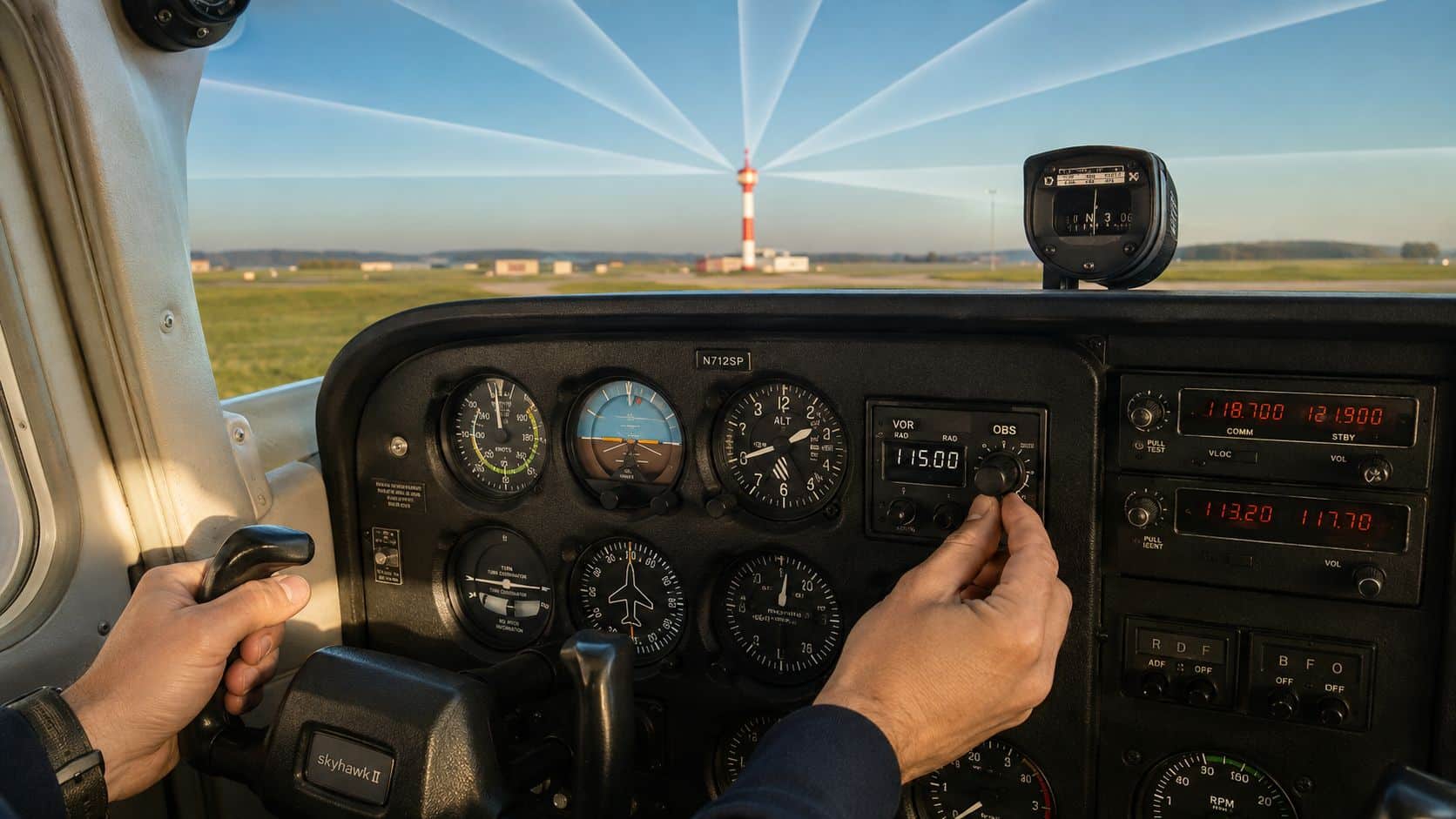
A student pilot taxis toward the run-up area, tunes a VOR frequency, and watches the CDI move while trying to remember what the TO/FROM flag means. The short answer is that VOR navigation gives an aircraft a bearing reference from a ground station, allowing a pilot to identify radials, intercept courses, track them through wind, and use conventional instrument procedures when GPS isn't available. Understanding VOR navigation still matters because the FAA is preserving a smaller VOR network specifically for backup operations, while airway structures and mixed aircraft fleets continue to change.
Table of Contents
- Why VOR Still Matters for Student Pilots
- How a VOR Ground Station Defines Radials
- Reading the VOR Instruments in Your Cockpit
- TO and FROM Logic Without Reverse Sensing
- Tracking Radials and Intercepting Courses
- Where VOR Fits in the 2026 Navigation Mix
- VOR in the Airwork and Approach Environment
- Practical Training Plan and Common Questions
Why VOR Still Matters for Student Pilots
The first VOR lesson can feel like a cockpit riddle. The student hears the station identifier, turns the OBS, sees the needle slide, and wonders whether the instrument is showing the aircraft's heading, the station's direction, or a course selected by the pilot. A CFI can simplify the entire problem with one question: what line from the VOR is the aircraft on, and which direction should the aircraft fly along that line?
Two practical options worth comparing
These are specific products pilots commonly compare for this type of flying. Confirm compatibility with your aircraft and instructor before ordering.
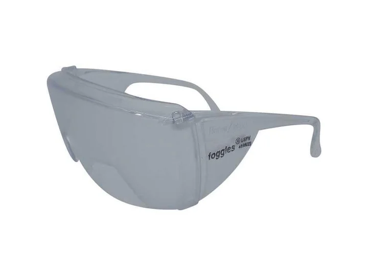 Instrument trainingFoggles Aviation IFR Training GlassesCheck current availability on Amazon (paid link)
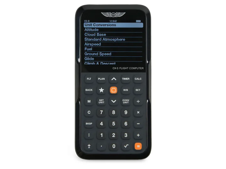 Flight planningASA CX-3 Flight ComputerCheck current availability on Amazon (paid link)
VOR training answers that question with raw, dependable information. By the end of a well-structured lesson, a pilot should be able to:
- Identify a radial: Determine the magnetic bearing from the station to the aircraft.
- Select a course: Set the desired course with the OBS or an equivalent display.
- Intercept and track: Use the CDI to capture the course, then correct for wind without chasing the needle.
- Brief a conventional approach: Understand the inbound course, station passage, altitudes, missed approach, and navigation requirements.
VOR isn't being preserved because the aviation system has forgotten to remove it. The FAA's Minimum Operational Network, introduced in 2011, repurposes the contiguous United States VOR system from a primary navigation structure toward a backup network. FAA planning called for discontinuing approximately 34% of contiguous U.S. VORs by 2030, about 306 facilities, while retaining enough coverage for backup navigation and training. FAA modernization planning also records that Phase 1 removed 82 VORs and Phase 2 was intended to remove 224 more.
That shift changes the syllabus. A student flying a modern glass-panel airplane may rely on RNAV for everyday routing, then encounter a VOR during a GPS outage, a conventional airway, a partial-panel exercise, or a rental aircraft with older instruments. At busy Southern California satellite fields, mixed fleets make that possibility practical rather than theoretical.
Practical rule: GPS may be the normal source of navigation, but VOR is the raw-data skill that keeps a pilot oriented when the normal source isn't available.
The useful mental model starts at the ground station and expands outward. First, learn what the station transmits. Then learn how the cockpit displays a radial. Only after those pieces make sense should the student work on interception, tracking, holds, and approaches.
How a VOR Ground Station Defines Radials
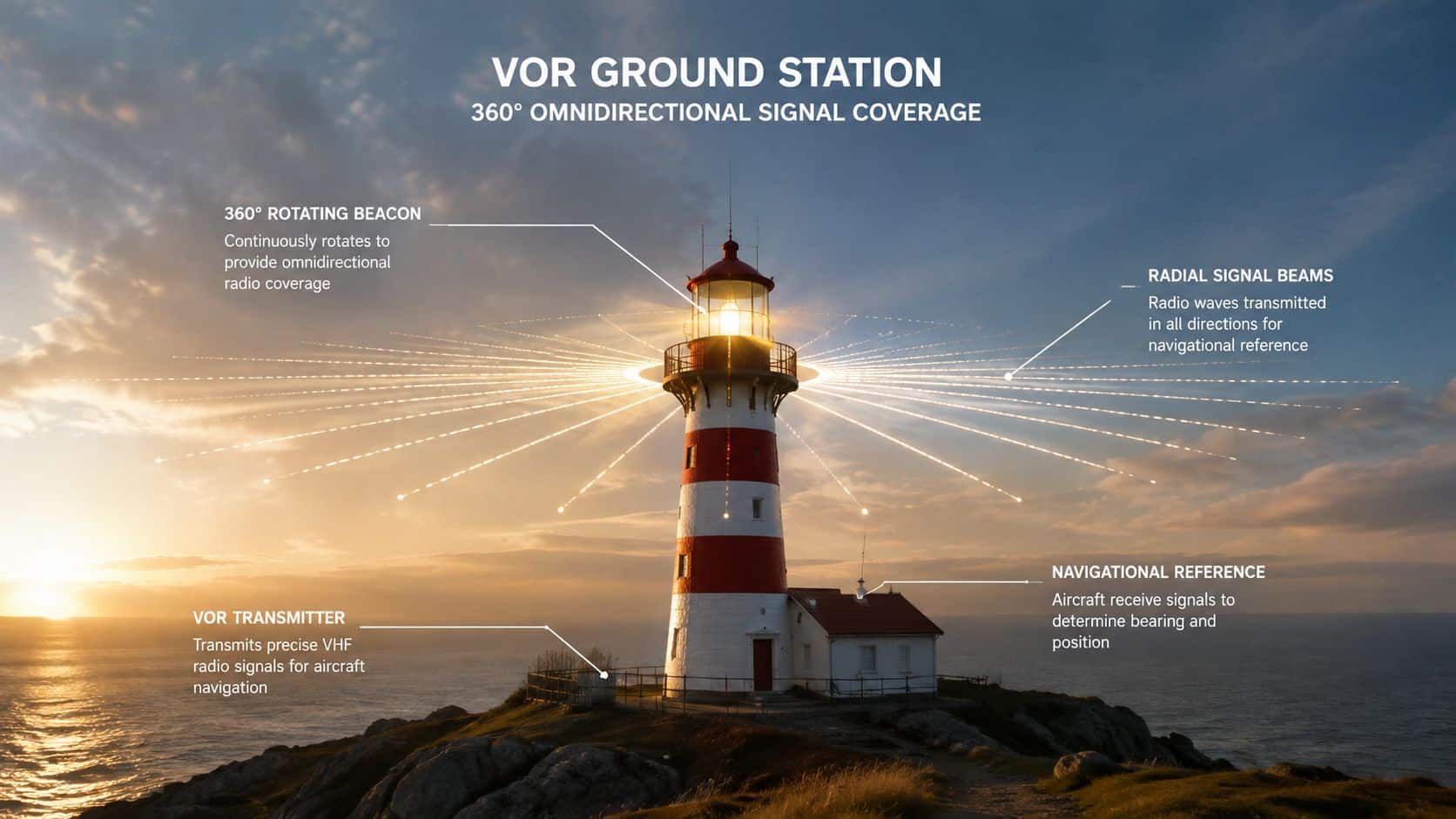
A VOR station can be visualized as a lighthouse with a precise radio reference. A traditional lighthouse sends light outward so an observer can recognize the station. A VOR sends signals that allow the receiver to determine the aircraft's direction from the station.
The station transmits a reference signal that maintains the same phase relationship in every direction, along with a variable signal whose phase changes around the station. The receiver compares those signals. The resulting phase difference corresponds to the aircraft's direction from the station, expressed as a magnetic bearing.
That bearing is called a radial. A radial always points from the VOR, never toward it. The 090 radial extends east from the station because an aircraft east of the station lies on a magnetic bearing of 090 degrees from that station. The 270 radial extends west, so an aircraft west of the station is on the 270 radial.
Why the radial stays independent of heading
The radial describes the aircraft's position relative to the station. It doesn't change because the aircraft turns. An airplane can fly north, south, or in a circle while remaining on the 090 radial, provided it stays on the east line extending from the VOR.
The signal still depends on practical limitations. VOR reception is line-of-sight, so altitude, terrain, distance, and the station's published service volume affect whether the signal is usable. The FAA's VOR High service volume lists 40 NM from 1,000 feet up to but not including 5,000 feet above terrain, 70 NM from 5,000 up to but not including 14,500 feet, 100 NM from 14,500 feet up to and including 60,000 feet, and 130 NM from 18,000 feet up to and including 45,000 feet. FAA service-volume guidance provides the applicable altitude and distance structure.
On a chart, a VOR symbol anchors these invisible lines. An airway may use one radial outbound from one station and another radial inbound to the next. The chart depicts the route, but the receiver determines how the airplane sits relative to each station.
Reading the VOR Instruments in Your Cockpit
A conventional OBS presents four pieces of information at once:
- The omni-bearing selector: The knob rotates the course card and selects a course.
- The CDI: The vertical needle shows lateral displacement from the selected course.
- The TO/FROM flag: The flag indicates whether the selected course leads toward or away from the station.
- The course index: The selected course appears under the index at the top of the instrument.
The instrument doesn't automatically tell the pilot which heading to fly. It shows the relationship between the selected course and the aircraft's position. A centered CDI means the aircraft is on the selected course line, not necessarily pointed along it.
An HSI organizes the same information more naturally. The compass card rotates with the aircraft's heading, while the course pointer shows the selected course in relation to the airplane symbol. The pilot sees whether the course lies left or right of the aircraft without mentally rotating a separate card.
Glass panels display the same underlying relationship with different graphics. A vertical course-deviation bar may move beside a selected course, while a magenta course line on a primary flight display shows the desired path. The screen can reduce workload, but it doesn't remove the need to understand radials, course direction, or station passage.
| Indicator Type | Course Setting Method | Deviation Display | Reverse Sensing Risk |
|---|---|---|---|
| Traditional OBS | Rotate the omni-bearing selector | Vertical CDI needle | High if the selected course is opposite the intended direction |
| HSI | Set the course pointer on the compass presentation | Course pointer moves relative to the airplane symbol | Low because the presentation aligns course and heading |
| Glass-panel CDI | Select the displayed course or navigation source | Vertical bar or course line displacement | Depends on source and presentation, so the pilot must verify the indication |
Reverse sensing is most likely during partial-panel work with an OBS. If the student sets the reciprocal course, the CDI may appear to demand a turn in the wrong direction. The prevention rule is simple: set the course that matches the direction of travel, then confirm the TO/FROM indication before trusting the needle. DuBois Aviation's glass cockpit and steam-gauge comparison is useful for seeing how instrument presentation changes without changing the underlying navigation logic.
TO and FROM Logic Without Reverse Sensing
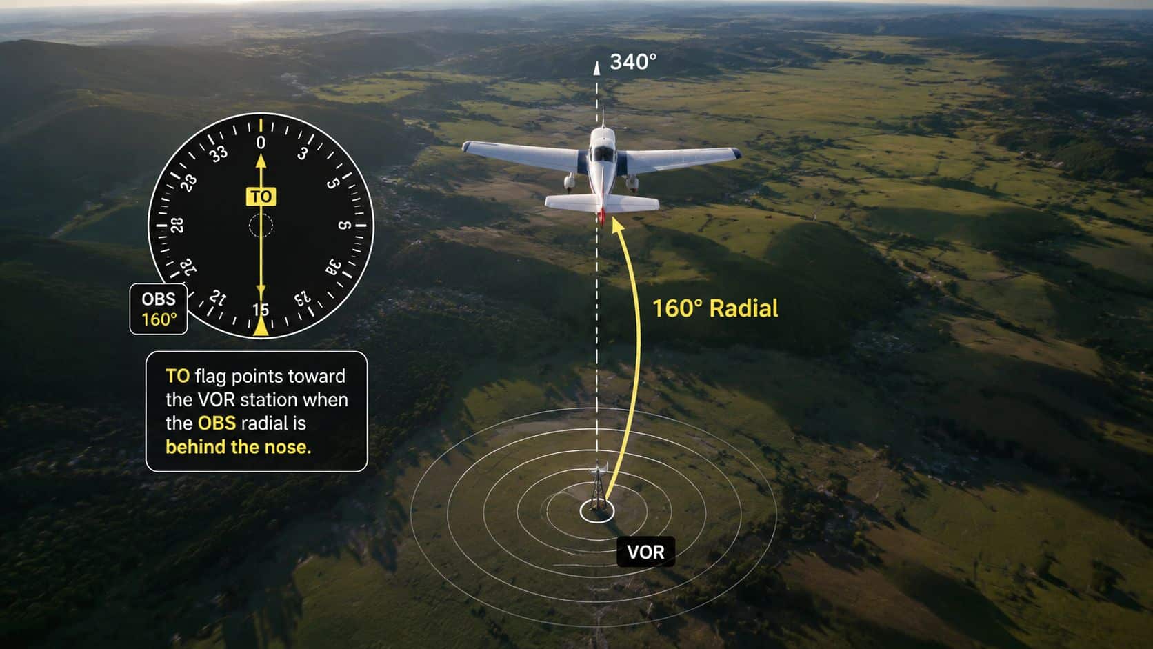
The TO/FROM flag becomes easier when the student stops treating it as a mysterious arrow. The selected course points TO the station when that course lies in the direction from the airplane toward the station. It points FROM when the selected course leads away from the station.
A top-down sketch helps. Place the airplane on a map, mark the VOR, and draw a line between them. Then draw the selected course through the airplane. If the arrowhead on that selected course points toward the station, the indication is TO. If it points away, the indication is FROM.
A quick cockpit drill
An eastbound aircraft can practice with three selected radials, 030, 150, and 300. The exact flag depends on the aircraft's position relative to the station and the course line selected, so the student should predict the indication on the chart first, then rotate the OBS and verify it in the cockpit. The value of the drill is the habit of predicting before accepting the instrument's answer.
The CDI doesn't know the pilot's intention. It only compares the selected course with the aircraft's position. If the pilot selects the reciprocal of the desired direction, “turn toward the needle” can produce the opposite result. An HSI largely removes this reverse-sensing trap because the course presentation remains aligned with the aircraft's heading.
A useful verbal script is:
- Station identified.
- Course selected.
- TO or FROM confirmed.
- Needle direction checked.
- Heading adjusted toward the selected course.
The script should be spoken softly during practice and mentally rehearsed during workload-heavy operations. The objective isn't to memorize an isolated trick. It's to make course direction, flag meaning, and CDI behavior one connected picture.
Tracking Radials and Intercepting Courses
Consider a training example: the aircraft is 10 NM east of the station, the desired course is 270 degrees, the wind is from 030 degrees at 15 knots, and the CDI shows full-scale deflection to the right. The right needle tells the pilot where the selected course lies relative to the aircraft's current position, so the immediate task is interception, not perfect tracking.
A practical two-step method works well:
- Intercept: Turn toward the selected course by a deliberate angle, perhaps 20 to 30 degrees in this training example, so the CDI begins moving toward center.
- Track: As the needle centers, reduce the intercept angle and establish the heading that keeps the aircraft on the course in the existing wind.
The exact correction isn't universal. It depends on groundspeed, wind, distance from the station, aircraft response, and how quickly the pilot recognizes movement on the CDI. The FAA describes VOR course alignment as generally accurate to plus or minus 1 degree. At 30 NM, a one-degree bearing error corresponds to approximately 0.52 NM of lateral displacement, so a small angular error becomes more consequential on a long leg. FAA navigation guidance
Lead and lag in plain language
A pilot tracking inbound should expect the wind correction to change near the station. The aircraft usually needs to lean into the wind to prevent drift, and the correction may need adjustment as geometry changes. Tracking outbound often requires the pilot to lead away from the wind's pushing direction, rather than waiting until the CDI has already moved far from center.
The student shouldn't chase every needle movement. A smooth bracket works better:
- If the needle moves right, turn right enough to regain the course.
- As the needle approaches center, reduce the correction.
- If the needle crosses center, make a smaller correction in the opposite direction.
- Hold the heading that keeps the needle near center instead of repeatedly swinging through it.
The cockpit flow is short enough to survive an ATC call:
Identify, tune, set, twist, observe, correct.
Identify the station. Tune the frequency. Set the intended course. Twist the OBS or course selector. Observe the TO/FROM flag and CDI. Correct with measured heading changes. That sequence keeps the pilot from turning first and asking what the instrument means afterward.
Where VOR Fits in the 2026 Navigation Mix
Calling VOR obsolete misses the important change. The system is being reduced and reorganized, but the FAA is deliberately retaining a backup structure for GPS-out operations. The FAA's VOR MON materials state that the network is being repurposed from the primary means of navigation to a backup, with nearly continuous coverage guaranteed at and above 5,000 feet AGL and a designated network for GPS-out contingencies. Current FAA VOR MON information
FAA updates also show that the network is actively changing in 2025. The agency reported that 200 of 302 targeted VORs had already been discontinued and 430 of 502 new VOR standard service volumes had been published as of August 2025. Those figures describe a managed transition, not the disappearance of conventional navigation.
| Source | Primary Use | Backup Role | 2026 Status |
|---|---|---|---|
| GNSS-based navigation | Normal RNAV routing and procedures | Useful when conventional equipment is unavailable | Primary in many fleets, but outage planning still matters |
| VOR | Conventional course guidance and procedures | Deliberate GPS-out reference | Reduced network, preserved strategically |
| ILS or LOC guidance | Precision or lateral approach guidance where available | Approach access during selected contingencies | Retained at designated facilities |
| Published airways | Structured enroute navigation | Route continuity during equipment or signal problems | Changes as facilities and routes are revised |
NAV CANADA's 2025 aeronautical information circular similarly describes a navigation environment in which surveillance and GNSS-equipped RNAV reduce the need for many navaids, while facilities anchoring airways or instrument approaches remain important. That makes VOR proficiency route-specific and fleet-specific.
At Chino and other busy towered airports, a student may train in a steam-gauge aircraft one day and a glass-panel aircraft the next. The display changes, but the pilot still needs to recognize a radial, verify the source, and understand what a conventional clearance requires. A career-track pilot can also use an intelligent chatbot for airlines as a supplementary resource for organizing broader airline-operation questions, but it doesn't replace approved charts, aircraft equipment, or current FAA publications.
The takeaway is direct: VOR is no longer the everyday backbone, but it remains a safety-critical backup skill. That is why instructors continue to evaluate raw-data tracking, holds, and conventional approaches even when the aircraft normally flies with advanced navigation equipment.
VOR in the Airwork and Approach Environment
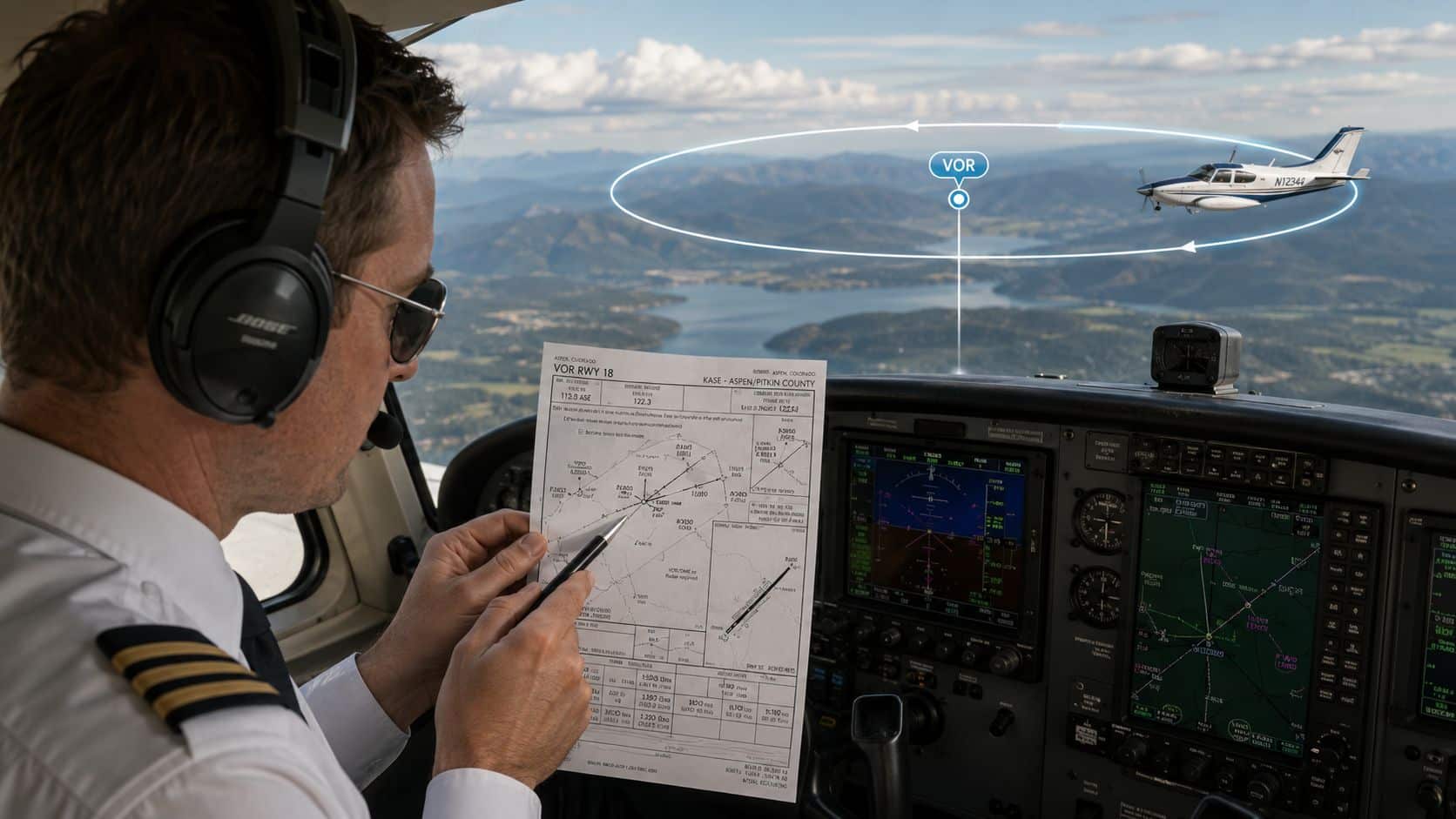
VOR knowledge becomes operational during procedures, not while the student is turning an OBS knob. A first training flight can connect three familiar tasks: an approach, a hold, and a DME arc. Each task uses the same station reference but asks the pilot to manage it differently.
On a VOR approach, the pilot first identifies the procedure's inbound course and approach fixes from the current chart. The briefing should include the final approach fix, crossing altitude, station passage, step-down restrictions, minimum descent altitude, missed approach course, and the navigation source required by the procedure. The pilot then tunes and identifies the station, confirms the course and TO/FROM indication, crosses the appropriate fix, and maintains the published altitude until authorized to descend.
Near the station, the CDI can become unstable. The pilot should avoid chasing the needle and instead use the station passage indication, timing, DME if available, and the published procedure. If the runway environment isn't visible at the applicable minimums, the missed approach must be flown as published. DuBois Aviation's instrument approach procedures training provides a relevant framework for connecting chart briefing with cockpit execution.
Holds and arcs use the same reference
At a VOR hold, the inbound course often corresponds to a published radial or course. The pilot identifies the holding fix, determines the direction of the hold, and selects the appropriate entry based on the aircraft's bearing to the fix and the published holding geometry. The inbound leg is then flown with the same disciplined tracking used on an airway.
A DME arc asks for a constant-radius path around the station. The pilot uses distance information to maintain the arc, makes small heading changes for wind, and watches the desired radial or approach course for the point where an intercept should begin. The arc isn't a collection of random turns. It is predictable geometry built from distance, radial, and heading.
A CFI should brief the chart before engine start, then ask the student to verbalize each transition. The strongest answers connect the instrument indication to the aircraft's location, rather than relying on a memorized knob movement.
Practical Training Plan and Common Questions
A flight-school sequence can turn VOR into a manageable set of proficiency gates. The targets below describe what the student should demonstrate, not a guaranteed number of hours.
- First flight, tune and identify: The student tunes the station, verifies the identifier, rotates the OBS, and explains the radial and TO/FROM indication without prompting.
- Second flight, intercept and track: The student selects an outbound or inbound course, chooses a sensible intercept heading, centers the CDI, and brackets wind correction smoothly.
- Third flight, hold: The student identifies the holding fix, selects the correct entry, anticipates station passage, and maintains the published course and altitude.
- Fourth flight, full approach: The student briefs the chart, verifies the navigation source, tracks the final course, observes altitude restrictions, and executes the missed approach when required.
Instrument flying training at DuBois Aviation can place these skills within a broader instrument syllabus covering aircraft control, procedures, and checkride preparation.
Questions that come up at the whiteboard
Why does the flag seem backward? The selected course may be the reciprocal of the direction the aircraft should fly. Recheck the course, the station position, and the intended direction before assuming the equipment has failed.
What happens at station passage? The CDI may fluctuate and the TO/FROM indication can change. The pilot should maintain attitude and altitude, avoid chasing the temporary needle movement, and resume normal tracking after the aircraft clears the station area.
Why does the needle scallop? Small heading changes, wind, signal geometry, and proximity to the station can produce movement. Smooth corrections are more useful than aggressive control inputs.
Does higher altitude guarantee better accuracy? Higher altitude can improve line-of-sight reception, but service-volume limits and station geometry still govern usable coverage. The pilot should use the published service-volume information and current procedures, not assume every signal is reliable at every distance.
Before each procedure, the cockpit flow remains the same: identify the station, set the course, confirm TO/FROM, verify the CDI, brief the next altitude and fix, then monitor the trend. Repetition turns that sequence into a habit that remains available when the GPS display is unavailable or the workload rises.
DuBois Aviation offers private, instrument, commercial, multi-engine, CFI/CFII/MEI, and helicopter training at Chino Airport, with aircraft and simulator resources for practicing both glass-panel and conventional navigation. Pilots and prospective students can visit DuBois Aviation to ask about course availability, aircraft rental, or a training plan that builds VOR proficiency into GPS-out readiness.