
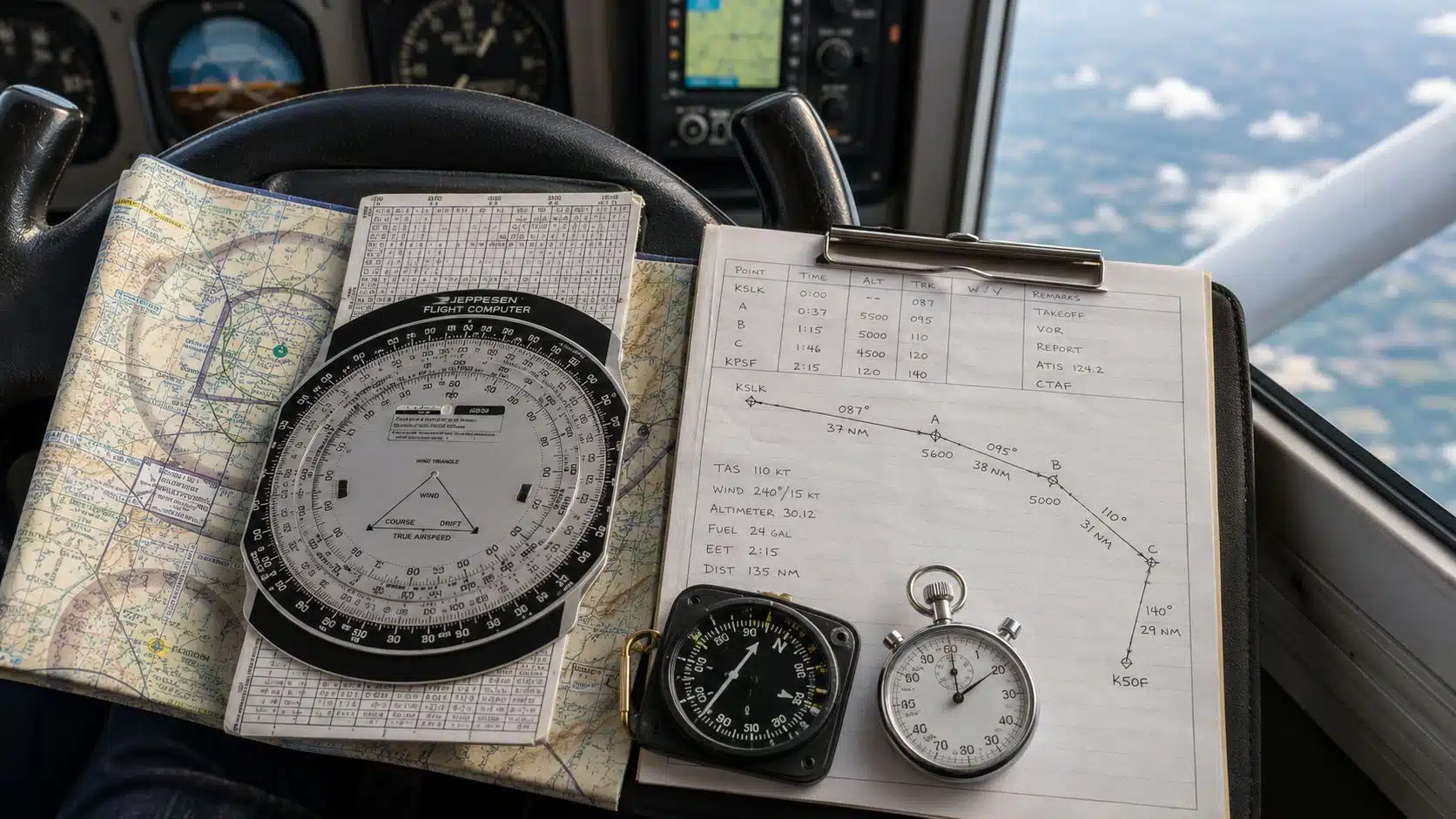
You're in the cockpit with a sectional folded open, the last checkpoint is behind you, and the next one should be easy to spot. Then the headwind is stronger than briefed, the landmarks look smaller than they did on the ground, and the GPS pauses long enough to make you glance down twice. That's the moment dead reckoning navigation stops being an old-school textbook term and becomes a practical skill you either trust or scramble to rebuild in the air.
For student pilots, the method feels simple at first, maybe even a little too simple. Start somewhere known, fly a heading, hold a speed, watch the clock, and estimate where you should be next. The catch is that the estimate is only as good as the wind, the heading you hold, and how quickly you notice drift before it grows into a real detour.
A good cross-country plan uses dead reckoning for three jobs, it keeps you oriented between fixes, gives you a wind correction you can fly, and preserves a usable navlog when the GPS needs a reboot. It also has hard limits. It won't give you precise position by itself, it won't guarantee terrain clearance, and it won't keep you clear of traffic.
Two practical options worth comparing
These are specific products pilots commonly compare for this type of flying. Confirm compatibility with your aircraft and instructor before ordering.
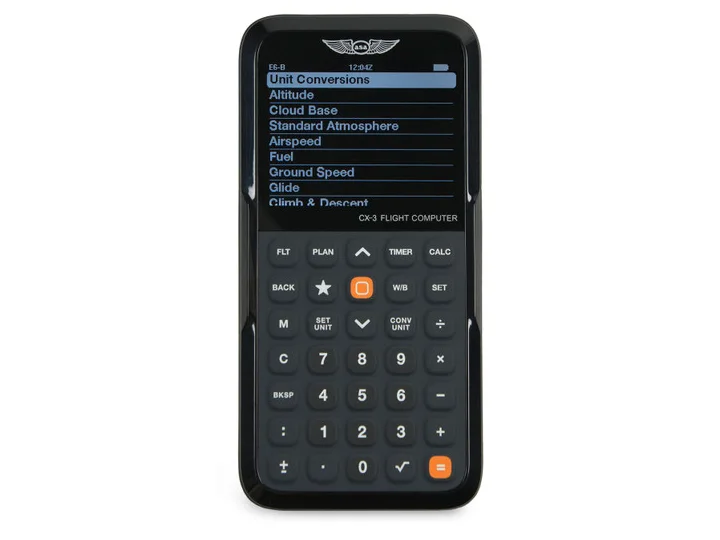 Flight planningASA CX-3 Flight ComputerCheck current availability on Amazon (paid link)
 Electronic flight bagApple iPad mini A17 Pro, Wi-Fi and Cellular, 128GBCheck current availability on Amazon (paid link)
That's why this still matters on a private pilot checkride, and why a student flying out of Chino toward the desert or the coast uses the same logic that helped Alcock and Brown cross the Atlantic. If you want a calm, repeatable way to think through the cockpit workflow, start with the math, then move to the habit, then to the backup plan.
Table of Contents
- Why Dead Reckoning Still Matters on Every Cross-Country
- The Core Idea Behind Dead Reckoning Navigation
- Inside the Wind Triangle and Groundspeed Math
- Planning and Flying a DR Leg Step by Step
- A Brief History of Dead Reckoning in the Cockpit
- How Fast DR Errors Grow and What Pilots Do About It
- Layering Dead Reckoning With Pilotage, Radio and GPS
- Dead Reckoning Drills to Try on Your Next Lesson
Why Dead Reckoning Still Matters on Every Cross-Country
A student files a leg, gets handed off to a CTAF, and suddenly the next checkpoint isn't obvious from the windshield. The map is still useful, the timer is still running, and the compass is still telling the truth even when the view outside doesn't feel like it. That's where dead reckoning navigation earns its place, not as a relic, but as the quiet structure underneath the whole leg.
What it solves in the real cockpit
Dead reckoning helps you answer three practical questions. Where should I be between fixes? What wind correction should I hold? What does my navlog say if the GPS takes a break? Those are not abstract schoolhouse questions, they're the ones that matter when you're trying to stay ahead of the airplane.
Practical rule: if you can't predict your next checkpoint time within your own logbook, you're not really navigating, you're just hoping to recognize the ground in time.
It's also worth understanding the method's limits before the chart gets messy. Dead reckoning does not give you precise position, it doesn't clear you from terrain, and it doesn't separate you from other traffic. It gives you a disciplined estimate, then asks you to verify that estimate with other references.
That's why the same logic still appears in training around Chino and beyond. A leg toward the desert or the coast can look straightforward on the sectional, but the air mass doesn't care about your confidence. The moment a light breeze becomes a stronger drift, the line on the chart starts to matter in a different way.
Cross-country planning fundamentals usually sit right next to this topic for a reason. A good route plan isn't only about getting from point A to point B, it's about knowing what should happen at minute five, minute ten, and minute twenty if everything is working the way you briefed it.
The Core Idea Behind Dead Reckoning Navigation
Dead reckoning is the practice of estimating your current position from a known starting point using heading, speed, time, and wind. In plain language, you start where you know you are, you fly a direction, and you project forward based on how long you've been moving. The estimate lives or dies on how well those inputs match reality.
The four inputs that matter
Think of it as four numbers working together. Starting position gives you the reference. Compass heading gives you direction. Speed tells you how far you're likely to go. Time turns speed into distance.
The wind triangle is the mental model that ties the whole thing together. The airplane may point one way, but the air mass can push it somewhere else. That's why course, heading, and track are not interchangeable words.
A simple walking analogy helps. If you're on a moving airport walkway and aim for a fixed sign at the far end, your body may be pointed at the sign, but the walkway can still slide you sideways. Your body angle is like heading. Your path over the ground is like track. The distance you cover is affected by both your own motion and the moving surface underneath you.
Pilot's note: a small heading mistake rarely looks dramatic in the first minute. The chart is where it shows up, because the line starts to slide away from the intended track.
That's why a one-degree heading error or a one-knot speed error doesn't stay small forever. It becomes cross-track error as the leg goes on. The method is not broken when that happens, it's doing exactly what estimation methods do. The job is to notice it early enough to correct it.
Inside the Wind Triangle and Groundspeed Math
A student usually wants the numbers in a very specific order, and that order matters. Start with true course, move to true heading, calculate wind correction angle, then work out groundspeed. If you reverse the sequence, you can still get an answer, but you'll spend more time untangling the logic than flying the leg.
Working the example the way a student should
Use one clean example and keep the pieces separate. A course of 270, a true airspeed of 110 knots, and a wind from 330 at 15 knots produces a true heading of 277, a groundspeed of 100 knots, and a wind correction angle of 7 degrees right. That's the sort of result you'd expect to verify on an E6B, then compare with what a digital flight plan computes for you.
The important part is not the gadget. It's understanding what the gadget is solving. The plastic E6B makes the wind triangle visible. A flight planning app hides the arithmetic, but it's still doing the same job in the background.
| Term | What it means in the cockpit |
|---|---|
| True course | The line you want to fly over the ground |
| True heading | The direction you actually point the nose |
| Wind correction angle | The amount you steer into the wind |
| Groundspeed | How fast you move over the ground |
The point of the math is to keep you honest. If the wind pushes from the left, you steer a little left of the desired course so your track comes out right. If the wind shifts, your correction shifts with it. That's why the heading you brief on the ground is a prediction, not a promise.
For crosswind thinking in more detail, this crosswind component guide helps connect the same wind logic to the runway. The cockpit lesson is the same in both places, you do the math before you need the correction.
Planning and Flying a DR Leg Step by Step
The cleanest way to teach dead reckoning is to make it a habit, not a concept. Start on the chart, measure the leg, write the numbers down, then fly the numbers you computed. That keeps the leg repeatable, which is exactly what a student needs.
Build the navlog before the airplane moves
Begin by plotting the course on the sectional and measuring the true course. Pull wind and temperature from the nearest valid source, then compute heading and groundspeed. After that, build the navlog with checkpoints, distance, ETEs, and fuel, because a time estimate means more when it sits next to the next visual cue.
Keep the checkpoints easy to see and easy to explain out loud. If you can't brief the route to a passenger in plain language, the route needs more work.
A clean DR navlog row usually looks plain, not fancy. Course, distance, speed, time, fuel, and the checkpoint name are enough to keep the leg organized.
| Checkpoint | Course | Distance (nm) | Groundspeed (kts) | ETE (min) | Fuel (gal) | Actual Time |
|---|---|---|---|---|---|---|
| First checkpoint | 270 | 12 | 100 | 7 | 1.4 | ____ |
Fly the leg like a timed verification, not a guess
Once airborne, hold the heading you planned and start the timer the way you briefed it. Cross-check each checkpoint against the planned time, then compare what you see outside with what the navlog predicted. If the actual time over a checkpoint is off by more than a couple of minutes, stop treating the error like trivia.
That's the moment to ask whether the wind was stronger than expected, whether the heading drifted, or whether the ground speed assumption was wrong. Don't wait for the next checkpoint to “fix itself.” A small disagreement becomes a bigger route change when you let it sit.
For a student pilot, that habit matters more than the exact tool used to build the plan. Paper, E6B, or an app all lead to the same cockpit behavior when they're used well, measure, predict, compare, correct.
A Brief History of Dead Reckoning in the Cockpit
The method has old roots because it solved a timeless problem. The Smithsonian notes that dead reckoning was used by Columbus and most mariners of the Age of Exploration, and Oxford University Press places key dead-reckoning longitude practice in the 17th and 18th centuries, before chronometers and lunar-distance methods became reliable enough to improve longitude calculation. The idea survived because it was portable, useful, and better than wandering.
One flight that showed what DR could do
On 14 June 1919, John Alcock and Arthur Brown left Lester's Field in St. John's, Newfoundland, and reached County Galway, Ireland at 8:40 a.m. on 15 June, completing the first non-stop transatlantic flight by dead reckoning. That crossing wasn't a classroom exercise. It was a serious use of estimated position under real pressure, with fog, mechanical trouble, and no modern positioning aid to lean on.
The achievement matters because it shows confidence with discipline behind it. The crew had to trust the method enough to keep going, but not so much that they ignored the limits of wind, visibility, and drift.
One failure that showed the cost of a bad estimate
On 8 September 1923, seven U.S. Navy destroyers were lost at Honda Point, and 23 lives were lost. UC Santa Barbara identifies the event as a navigational tragedy tied to estimated position. That disaster is a hard reminder that a dead reckoning error is often invisible until the shoreline, current, or fog makes it impossible to ignore.
Britannica notes that ocean currents and tidal streams had to be charted to reduce drift error, and that's the old lesson in its best form. Dead reckoning was never a shortcut. It was a serious method that demanded real attention, and the same is still true in training today.
How Fast DR Errors Grow and What Pilots Do About It
The question students ask most often is simple. How wrong can I be? The FAA safety handout gives a blunt rule of thumb, 90% of the time the maximum dead-reckoning error per hour of flight is 20 miles plus 1% of the estimated distance flown during that hour. That doesn't mean every leg will be that far off, but it does mean the method can drift faster than beginners expect if they let it run unchecked. FAA safety handout on dead reckoning error
What small input errors do over time
A more technical navigation source adds a useful way to think about accumulation. A 1-knot speed error over 24 hours produces 24 nautical miles of position error, and a 5° course error at 10 knots over 24 hours creates about 20 nautical miles of cross-track error. Those examples are longer than a normal practice leg, but they show the same pattern students see sooner in the airplane, tiny mismatches stack up.
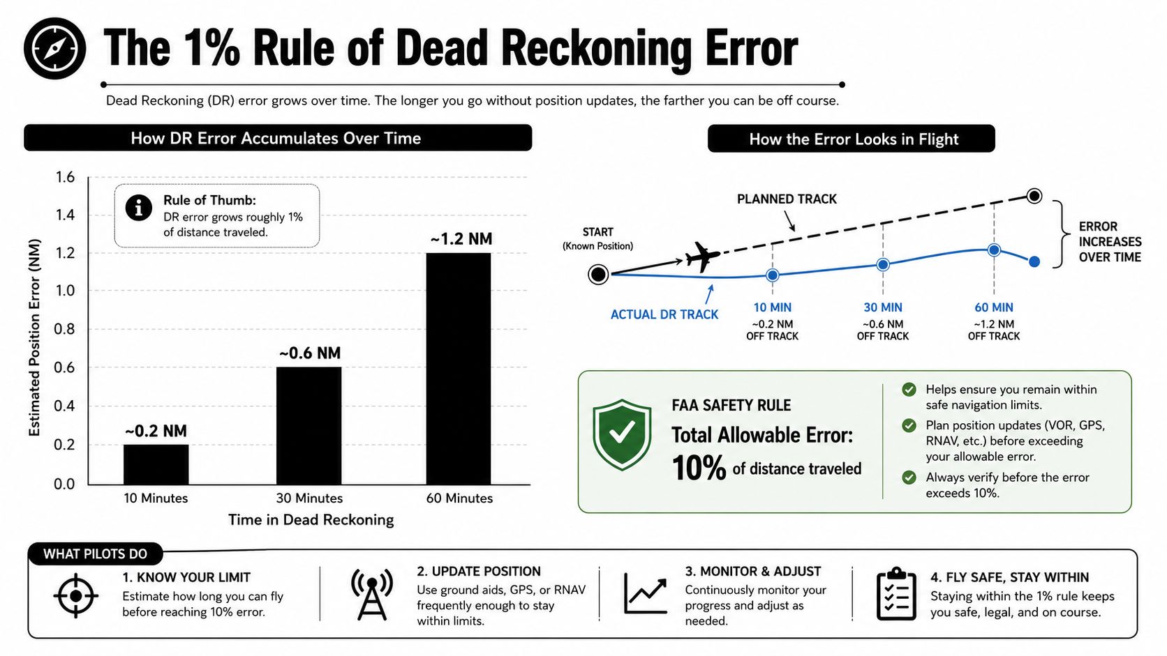
The fix is not to abandon dead reckoning. The fix is to treat it like a living estimate. Every checkpoint, clock check, and visual reference is a chance to pull the estimate back toward reality before the gap gets too wide.
What pilots do to stay ahead of the error
A student who logs each checkpoint time, compares it to the planned ETE, and looks for a landmark before the next minute rolls by is doing the right work. Radio bearings and visual pilotage matter because they reset uncertainty before it turns into a lost procedure. If the route starts to disagree with the chart, the pilot should question the estimate immediately instead of assuming the airplane is “almost there.”
Good habit: the first sign of drift is not failure, it's data. Use it early, while the fix is still easy.
That is the practical heart of the skill. Dead reckoning gives you a usable picture, but only if you keep testing the picture against the world.
Layering Dead Reckoning With Pilotage, Radio and GPS
Dead reckoning works best when it's part of a wider navigation system. Pilotage gives you visual confirmation, radio navigation gives you a line of position when it's available, and GPS gives you direct readout and course guidance. Dead reckoning is the thread connecting those references between updates.
How the layers work together
A good VFR cross-country does not force one method to do everything. You use pilotage to confirm what you see outside, radio navigation to anchor your position when a station or bearing is available, and GPS to verify and refine the plan. Dead reckoning sits underneath all of it, keeping track of where you should be in the gaps.
That matters even more in modern avionics. Technical sources describe GPS-based navigation as using dead reckoning to predict position between GPS updates and smooth GPS noise, and they note that dead reckoning is the default mode when some flight management system inputs fail. The point is simple, the old logic still lives inside the glass cockpit.
For GNSS-denied scenarios, modern GPS training and fallback navigation is a useful way to think about how the backup mode behaves when satellite guidance isn't there. A pilot who understands dead reckoning on paper is already practicing the mental model the avionics use when they need to bridge the gap.
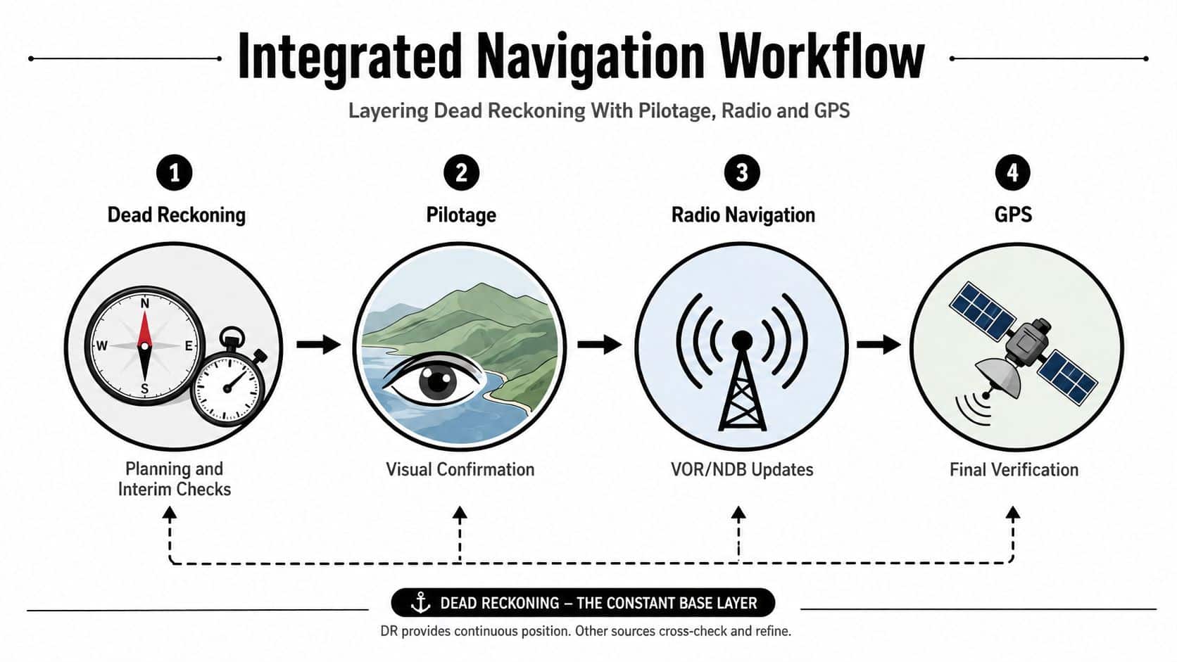
The safest navigation plan is rarely the most advanced one. It's the one where each method checks the others before the error gets a chance to grow.
That's the right way to think about dead reckoning now. It isn't a relic sitting in the same category as a forgotten map. It's one leg of the stool, and the flight gets more stable when all the legs are working together.
Dead Reckoning Drills to Try on Your Next Lesson
A useful drill is one that changes how you fly next week. Ask for a single-leg out-and-back from KCNO with checkpoints chosen for visibility, then fly it with the iPad stowed until the checkpoint times line up with what you briefed. That forces you to rely on the route you computed instead of the one you happen to see on a screen.
Four practice drills that build real confidence
Single-Leg DR. Fly one known leg, estimate the time, and compare your planned and actual checkpoint times. The goal is to see how well your wind and speed assumptions hold up in the air.
Time-to-Station. Use dead reckoning to predict a VOR station passage, then verify when you cross it. This is a clean way to connect the math to an airwork result.
Multi-Leg Route. Plan a three-leg cross-country with pilotage checkpoints and fly it as a route, not a straight line. You will see how one leg feeds the next.
Error Measurement. Compare estimated position to actual position after a timed leg, then identify the first sign of drift before the next fix. That trains your eye to catch error early.
If you want a quick way to document what you learned, a tool like best YouTube transcript extensions can help you save a debrief or instructional video summary and pull out the parts you want to review later. It's handy when you're trying to capture the wording of a CFI debrief without missing the details that matter.
Before the lesson, keep one short checklist in front of you, course, heading, groundspeed, ETEs, fuel, checkpoints, lost procedure. If you can brief those items clearly, you're ready to fly the leg with purpose instead of optimism.
DuBois Aviation helps student pilots turn navigation theory into cockpit habit with one-on-one instruction, structured training, and real-world cross-country practice at KCNO. If you want to build stronger dead reckoning skills with a CFI who'll slow the process down and make each step make sense, visit DuBois Aviation and start planning your next lesson.