

You're sitting at the kitchen table with a sectional chart open, a weather app on your phone, and a logbook that's finally starting to look real. The next step isn't just “go fly farther.” It's learning how to make a flight legal, safe, and teachable when the route leaves your home airport and the tower, the weather, and the fuel math all matter at once. That's what cross-country flight training is really building, a pilot who can plan hard, adapt fast, and still bring the airplane home with margins intact.
Table of Contents
- What Cross-Country Flight Training Actually Requires
- Planning the Flight Before You Ever Step to the Aircraft
- Navigation Techniques You Actually Combine in the Air
- Preparing for the Solo Cross-Country and the Endorsement
- Night and Instrument Cross-Country Considerations
- Common Cross-Country Mistakes and How to Fix Them
- How DuBois Aviation Supports Each Phase of Training
What Cross-Country Flight Training Actually Requires
The first time a student realizes the solo cross-country is no longer an abstract syllabus item, the whole exercise gets serious. It stops being about drawing a line on a chart and becomes about proving you can launch, travel, communicate, and land away from home without improvising your way into a problem. Under U.S. training rules, a qualifying cross-country for private pilot training is tied to a landing point more than 50 nautical miles from departure, and the training path for an airplane single-engine private pilot certificate includes at least 40 total flight hours, 20 hours of dual instruction, 10 hours of solo flight, and at least 3 hours of cross-country flight training with an instructor. The solo requirement is even more specific, a 150 nautical mile solo cross-country with full-stop landings at three points, including one leg longer than 50 nautical miles. Those thresholds are spelled out in the private pilot requirements summary at First Flight.
Two practical options worth comparing
These are specific products pilots commonly compare for this type of flying. Confirm compatibility with your aircraft and instructor before ordering.
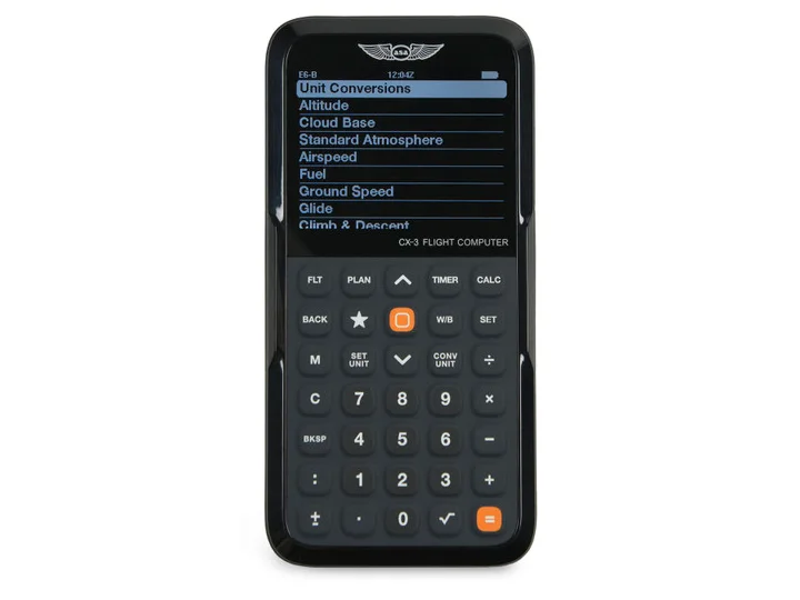 Flight planningASA CX-3 Flight ComputerCheck current availability on Amazon (paid link)
 Electronic flight bagApple iPad mini A17 Pro, Wi-Fi and Cellular, 128GBCheck current availability on Amazon (paid link)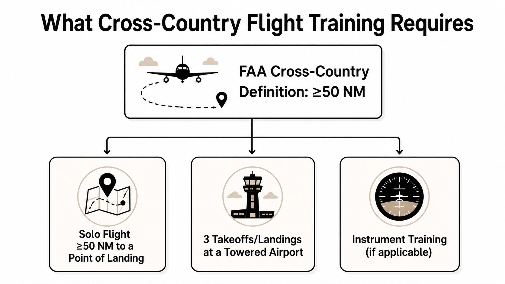
Why the numbers matter in the real world
Those numbers aren't arbitrary. The 50 nautical mile line separates local flying from true trip planning, which means the student has to think about weather, alternates, fuel, and runway options instead of just pattern work. The 150 nautical mile solo with three full-stop landings forces route discipline, airport sequencing, and cockpit workload management. It's not a “go see another airport” exercise, it's a judgment test with a navigation component.
The same idea shows up in instrument training, where a cross-country is defined by a landing point more than 50 nautical miles away, and the longer IFR cross-country must be at least 250 nautical miles with approaches at three different airports. That makes the definition objective, which matters when students or buyers assume cross-country means the same thing everywhere. It doesn't.
Practical rule: if the airplane, the route, or the weather can't support those exact thresholds cleanly, the flight isn't ready yet.
For a quick planning reference on route structure and checkpoints, a useful overview is this VFR cross-country planning guide. EASA also uses a different framework, defining cross-country as a flight between two different aerodromes with a straight-line distance of at least 50 nautical miles, so international pilots shouldn't assume U.S. and European rules line up one-for-one. That distinction matters if you train, ferry, buy, or sell aircraft across regulatory systems.
Planning the Flight Before You Ever Step to the Aircraft
Cross-country mistakes usually start long before the engine does. A student can be sharp in the air and still build a weak flight on the ground by treating planning as a route sketch instead of a decision process. The most useful workflow is to break it into five buckets, navigation, weather, fuel, contingencies or emergencies, and communications. That's the order I want students to use when they brief a flight, because it keeps them from skipping the item that turns out to matter most that day.
The five buckets that keep a flight legal and sane
Navigation comes first because the route has to make sense on the chart and in the cockpit. Weather comes next, because a route that looks fine on paper can become a trap if ceilings, winds, or convective activity shift before departure. Fuel is the hard limit, not a suggestion, and AOPA's training guidance says legal minimum reserves should be treated as a floor, with about one hour of reserve fuel in day VFR and one and a half hours at night as a stronger safety target, while also comparing estimated fuel against actual fuel after the flight (AOPA training guidance).
Communications and contingencies are the two buckets students often underweight. That's where alternates, reroutes, lost comms planning, and emergency options belong, not as afterthoughts but as part of the initial go/no-go. A flight can be legal and still be a bad idea if the destination is one weather update away from becoming a diversion.
Treat the legal minimum as the minimum, not the target.
A good planning habit is to assume the route can change after takeoff. NOTAMs, TFRs, and local weather can invalidate a “perfect” route that was drawn the night before, which is why the safer habit is to verify the departure, destination, and alternates again before engine start. For an overview of how student pilots file and activate plans, this flight plan filing guide is a practical companion.
What to check before you launch
- Navigation: plot the course, confirm checkpoints, and verify that each leg supports the training objective.
- Weather: check current and forecast conditions for the departure, route, destination, and alternates, then ask whether the route still works if the forecast shifts.
- Fuel: compare planned burn to usable fuel, then build in the reserve you're comfortable with, not just the minimum you can legally scrape by on.
- Contingencies: pick alternates and decide, before takeoff, what would make you divert.
- Communications: make sure frequencies, flight following options, and backup contact procedures are ready before you're busy in the air.
That discipline matters even more for pilots buying or selling airplanes, because range, fuel capacity, avionics, and runway performance directly affect whether the aircraft can support ordinary cross-country use without constant compromise.
Navigation Techniques You Actually Combine in the Air
Students often ask which navigation method is “best.” That's the wrong question. The skill is blending four methods at once so that one doesn't fail the whole flight. Dead reckoning, pilotage, GPS, and radio navigation each solve a different part of the problem, and the pilot who flies a solid cross-country uses all of them instead of defending one favorite.
Dead reckoning and pilotage build the baseline
Dead reckoning gives you the time, heading, and speed math that keeps the flight honest. If your estimated groundspeed and fuel burn are wrong, everything downstream gets noisy. Pilotage anchors that math to the ground, using visible checkpoints, terrain, rivers, highways, and other landmarks to confirm that the airplane is where the nav log says it should be.
If you want to sharpen the visual side of this skill, the fundamentals of reading a topographic map and compass translate well to aviation thinking, especially the habit of matching the paper picture to the actual world outside the windshield. The point isn't to turn a pilot into a hiker. It's to reinforce spatial awareness, which is exactly what students need when the cockpit gets busy.
GPS and radio nav are backups, not crutches
GPS adds precision and reroute flexibility, especially when weather, traffic, or airspace changes force a direct-to or a new sequence of waypoints. That's where GPS navigation training pays off, because the system is only useful if the pilot understands what it's doing and what it isn't doing. A student who can punch buttons but can't cross-check the result hasn't really learned GPS.
Radio navigation matters for a different reason. VORs, NDBs, and ATC vectors train the pilot to keep moving when the screen is unhelpful or unavailable, and that's one reason older techniques still show up on checkrides. In busy towered airspace, flight following also helps, because it gives you an extra set of eyes and a voice in the loop when the route changes or traffic gets dense.
What should happen every few miles
- Cross-check position: verify where you are against a checkpoint, not just the magenta line.
- Update the fuel picture: don't wait until the destination to discover the numbers were optimistic.
- Watch for diversion cues: if the route starts drifting, make the correction early.
- Brief the reroute before it's urgent: the student who has already thought through an alternate handles the surprise better.
That habit set becomes much more important in a Class D environment, where tower instructions, departure sequencing, and nearby traffic can compress the time you have to think. Cross-country proficiency is not choosing one navigation tool, it's using the right tool at the right moment without losing the bigger picture.
Preparing for the Solo Cross-Country and the Endorsement
A student doesn't earn the solo cross-country endorsement because the last flight felt smooth. The instructor signs it because the student can make reasonable decisions under pressure, stay organized, and handle the route without needing a running commentary. That's why the path to solo cross-country usually starts with supervised dual trips, then a careful check of how the student reacts when the plan changes.
The route matters, but the endorsement matters more
U.S. student-pilot rules are specific. A solo flight to another airport within 25 nautical miles is allowed only if the purpose is practice takeoffs and landings. Repeated solo cross-country flights to another airport within 50 nautical miles require the instructor to have trained the student both directions over the route, endorsed proficiency in the logbook, and placed both the solo and solo cross-country endorsements in the student's logbook for the aircraft category and make or model to be flown, as summarized in the regulation at 14 CFR 61.93.
That rule set matters because it limits what a student can legally do before soloing away from the home airport. It also protects the student from the temptation to treat “I've been there before” as enough. Route-specific training and aircraft-specific authorization are part of the safety system.
What an instructor is really evaluating
The CFI is watching for more than smooth control inputs. The questions are simple, but they reveal a lot:
- Can the student explain the route without guessing?
- Does the student know what would force a diversion?
- Will the student respect weather that's getting worse instead of hoping it improves?
- Can the student handle a towered airport without getting flustered?
A student who asks, “What's my out?” is usually safer than the student who only asks, “Can I make it?”
That's why the endorsement often arrives after a quiet, unglamorous briefing, not after a dramatic breakthrough. The flight is supposed to prove judgment. If the student keeps trying to salvage a questionable plan, the endorsement stalls, and that's the right outcome. For aircraft owners and sellers, this is the same reason route-specific capability matters in real life, an airplane that's fine for local work may not be a comfortable training platform for cross-country repetition.
Night and Instrument Cross-Country Considerations
Night and instrument cross-country flying look similar from the outside. They aren't. Night VFR adds visual illusion, lighting discipline, and reserve management to a flight that already depends on good planning. Instrument cross-country adds workload, procedure discipline, and a different way of making decisions when the outside world stops being the primary reference.
Night changes how the cockpit feels
At night, chart reading gets harder, depth perception changes, and the wrong cockpit light can make a student slower instead of more precise. That's why reserve fuel discipline matters even more after dark, and why the reserve standard mentioned earlier should feel like a floor rather than a target. A pilot who plans a night cross-country like a daytime hop is setting up a fatigue problem before the wheels leave the ground.
Simulator time helps here, because it lets students rehearse radio work, instrument scan, and diversion decisions without burning daylight or becoming task-saturated in the airplane. The point is not to replace real flying. It's to make the first real cross-country less expensive in both money and mental bandwidth.
Instrument cross-country is a different skill set
FAA instrument training uses a cross-country definition tied to a landing point more than 50 nautical miles away from departure, and the longer IFR cross-country requires at least 250 nautical miles with approaches at three different airports, according to the training requirements summarized in the material cited above. That structure pushes a student to manage procedures, not just scenery. The route is still important, but the skill is maintaining decision quality when the workload is high and the visibility is low.
The useful question is not whether instrument flying is “harder” than night VFR. It's what the pilot must be ready to handle. Night cross-country stresses visual judgment. Instrument cross-country stresses procedural discipline and workload management. Different risks, different fixes.
If the airplane, the weather, or the pilot isn't comfortable with the added workload, delay the flight.
Common Cross-Country Mistakes and How to Fix Them
The biggest cross-country mistakes are usually boring. That's the frustrating part. Students don't typically lose track of where they are because they can't read a map. They get into trouble because they skipped a planning step, accepted a weak assumption, or let the flight plan become stale after taxi.
The errors that keep showing up
| Common Mistake | Better Habit |
|---|---|
| Filing the route and then forgetting it after departure | Activate, monitor, and close the flight plan with the same discipline you used to file it |
| Skipping an alternate because the destination looked good earlier | Pick a real alternate and re-check it before takeoff |
| Trusting the fuel estimate without comparing it to actual burn | Reconcile planned fuel against actual fuel after the flight |
| Treating NOTAMs and TFRs as paperwork | Review them again close to engine start |
| Pushing through marginal weather because the route is already planned | Make the go/no-go decision based on current conditions, not sunk effort |
| Rehearsing only the primary route | Brief a diversion before takeoff so it's not a surprise in flight |
Why planning failures cause more trouble than navigation
Training material aimed at student pilots repeatedly emphasizes weather, alternates, fuel burn, and contingencies, and that emphasis is telling. The route rarely fails first, the assumptions do. If the destination goes marginal, or a TFR appears, or the fuel number is tighter than expected, the student who built a backup plan is calmer and faster. The student who didn't usually starts making decisions too late.
The other common mistake is overconfidence in a smooth first leg. A calm departure tells you almost nothing about the return or the diversion. Cross-country proficiency grows when the pilot expects changes, not when the pilot hopes the day stays simple.
A safer habit set
- Rebrief before taxi: weather, NOTAMs, fuel, alternates.
- Recalculate after each change: a delay on the ground can change the route in the air.
- Mentally rehearse the escape plan: know the nearest options if the destination closes up.
- Close the loop after landing: compare planned fuel to actual fuel and note what changed.
For pilots who buy or sell airplanes, these habits matter because an aircraft's real value includes how well it supports sane cross-country operations, not just how clean it looks on the ramp. An airplane that makes planning easier is usually a more honest machine to own.
How DuBois Aviation Supports Each Phase of Training
A solo cross-country from a busy towered Class D airport like Chino, KCNO, starts with radio work that never feels optional. Students hear clearance instructions, taxi changes, runway sequencing, and traffic calls from the first lessons, so cross-country training develops in the same kind of airspace where those habits have to hold up later. That setup matters because cross-country flying is not just about getting from one checkpoint to the next, it is about making decisions while the airport environment keeps moving around you.
Fleet variety and simulator time change the learning curve
DuBois Aviation trains in a well-maintained fleet that includes multiple Piper Cherokees, a Cessna 150, a Mooney M20B, and a Piper Apache, along with Robinson and Enstrom helicopters. That variety changes how cross-country planning gets taught. A student moving from one cockpit to another has to account for speed, useful load, cockpit layout, climb performance, and fuel planning in a way that matches the airplane in front of them, not a generic worksheet.
That difference shows up fast in real training. A Cherokee can make one set of planning choices feel reasonable, while the Mooney asks for tighter timing and more disciplined fuel management. A student who has only flown one airframe can mistake that aircraft's habits for universal rules. A mixed fleet exposes the trade-offs early, before those assumptions show up on a solo trip.
The in-house simulator adds another layer. Students can work through instrument cross-countries, diversions, and radio procedures before they are trying to handle everything in the airplane at once, which helps lower task saturation without lowering the standard. One-on-one instruction using Jeppesen materials keeps the training tied to the student's current stage, and the seven-day scheduling plus online flight schedule make it easier to keep momentum when weather or work interrupts the week.
In a mixed-fleet environment, the airplane teaches the trade-off as much as the instructor does.
That matters for students who may rent or own later, because the airplane they choose will affect how forgiving cross-country planning feels on an actual trip. A cockpit that gives clear fuel and navigation cues makes the preflight work easier to trust. A tighter or faster airplane reveals planning gaps sooner.
DuBois Aviation also supports the broader path with private, instrument, commercial, multi-engine, helicopter, and airline career programs, so the cross-country work sits inside a larger training sequence instead of ending at one solo flight. If you want to build real trip-planning skill in a towered-airport environment, contact DuBois Aviation and ask about scheduling a lesson that matches your current stage.