
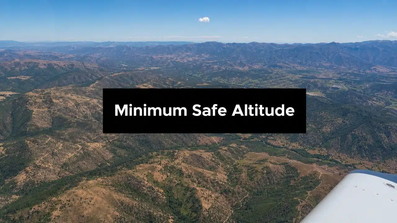
Minimum safe altitude: regulation vs. charted altitude
FAR 91.119 sets general minimum altitudes for VFR operations, while IFR charts publish route- and procedure-specific altitudes for different purposes. These are not interchangeable. An approach-chart MSA is primarily an emergency reference within a defined area; an MEA applies to a published airway segment and includes obstacle-clearance and navigation-signal considerations.
- Congested areas: generally 1,000 feet above the highest obstacle within 2,000 feet horizontally.
- Other than congested areas: generally 500 feet above the surface, with additional distance rules over sparsely populated areas or open water.
- Everywhere: maintain enough altitude to permit an emergency landing without undue hazard if a power unit fails, except when necessary for takeoff or landing.
Read the current text of 14 CFR 91.119. Helicopters have a regulatory exception with conditions, so avoid applying airplane rules without reading the complete section.
You're planning a flight, maybe your first solo cross-country, and the weather looks good enough that the altitude question doesn't feel urgent. Then the route starts crossing neighborhoods, ridgelines, antennas, or open water, and the simple question shows up fast: how low can you legally and safely fly?
Two practical options worth comparing
These are specific products pilots commonly compare for this type of flying. Confirm compatibility with your aircraft and instructor before ordering.
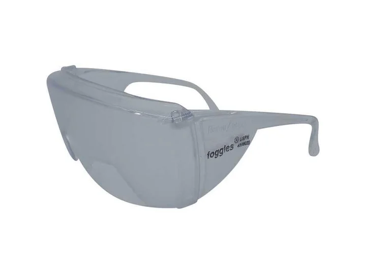 Instrument trainingFoggles Aviation IFR Training GlassesCheck current availability on Amazon (paid link)
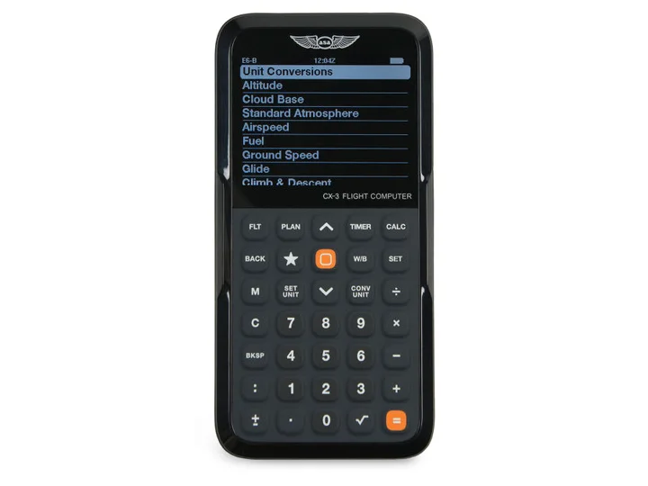 Flight planningASA CX-3 Flight ComputerCheck current availability on Amazon (paid link)
That's where many student pilots get tripped up. They memorize a few numbers, pass the quiz, and still miss the core lesson. Minimum safe altitude isn't just a regulation to recite. It's a risk-management habit. It blends legal minimums, charted obstacle clearance, terrain awareness, and one question that matters every time you move the throttle forward: if the engine quit right now, what are my options?
More Than Just a Number
A student leaves Chino on a smooth morning. The airplane climbs well, radios are busy but manageable, and the route ahead looks simple on the sectional. South of the airport, houses and roads pack tightly together. A little farther out, the ground opens up. Beyond that, rising terrain starts to shape the horizon.
That changing view is exactly why minimum safe altitude can't be treated like one fixed answer. The safe altitude over a built-up area isn't the same as the safe altitude over open land, and neither of those decisions should be made without thinking about obstacles, wires, towers, and where you'd go if the engine got quiet.
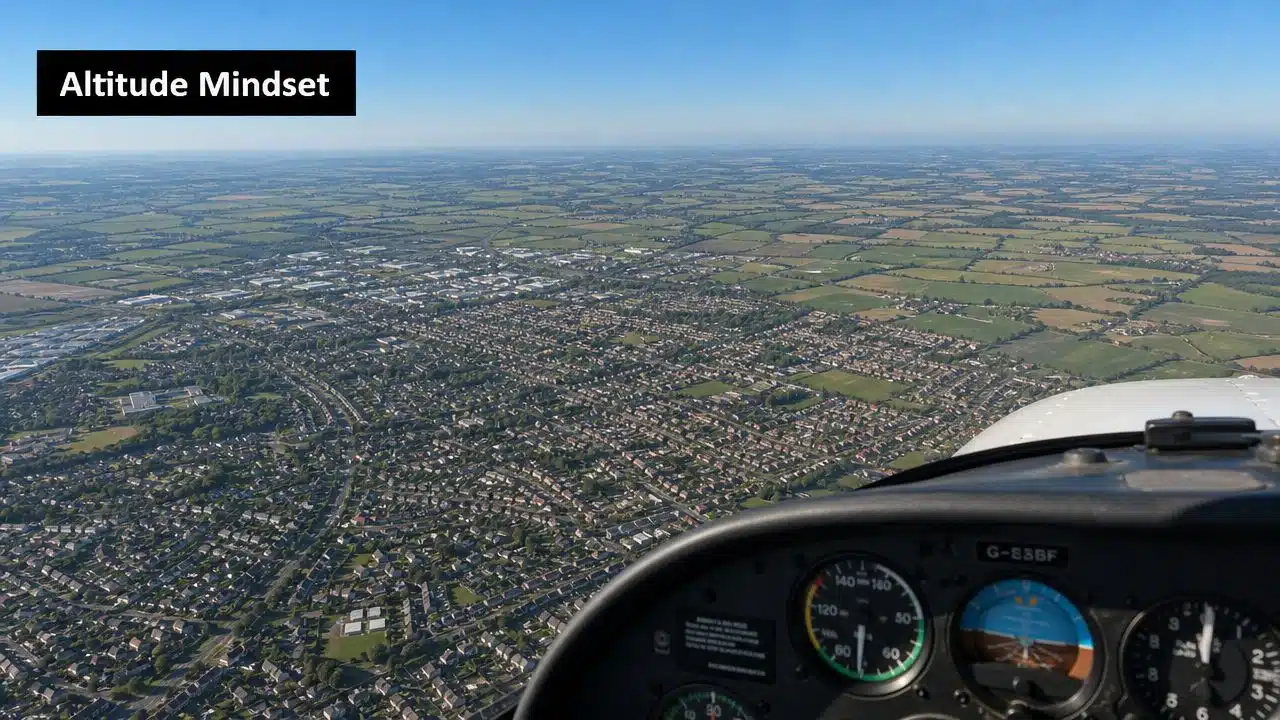
Why pilots get this wrong
Most confusion starts when a pilot turns minimum safe altitude into a memory game. They remember “500 feet” and “1,000 feet,” but forget that those numbers only make sense when tied to a specific environment.
A neighborhood, a shopping center, a ridgeline with towers, and a dry basin all ask different questions. The rule isn't trying to make your life harder. It's forcing you to notice what's below you before it becomes urgent.
Flying low is never just about whether the FAA would approve it later. It's about whether you've left yourself enough time, space, and choices.
The instructor view
When I teach this subject, I tell students to think of altitude as time in the bank. More altitude often means more time to troubleshoot, more glide range, and more places to land. The legal floor matters, but the smart altitude is usually higher.
That matters even more in places like Southern California, where one short leg can take you from suburban sprawl to open basin to mountain foothills. The number changes because the risk picture changes.
Understanding FAR 91.119 The Legal Foundation
A student pilot can memorize 500 feet and 1,000 feet and still make a bad altitude choice.
That happens because FAR 91.119 is not just a list of numbers. It is the legal floor for low-altitude flight, and the rule keeps pulling you back to one practical question. If the engine quits right now, do you have a reasonable way to land without creating undue hazard for people or property below? The full regulation says exactly that in 14 CFR 91.119 in the eCFR.
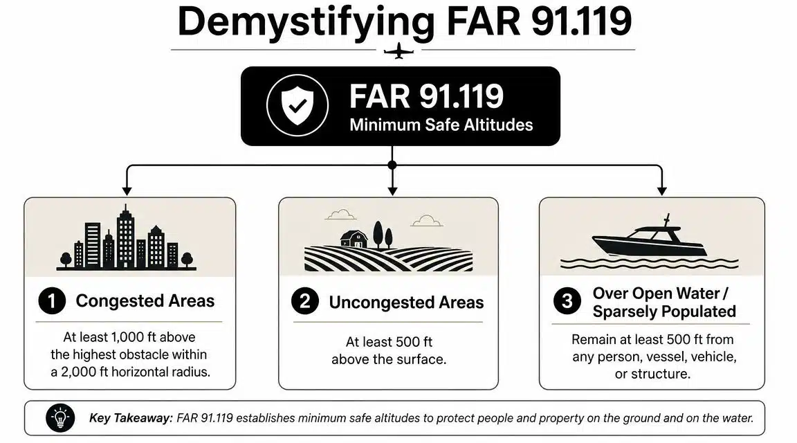
What the rule says in plain English
Start with the part students often miss. The regulation does not ask only, “How high am I above the ground?” It also asks, “What is under me, how crowded is it, and what obstacles change the clearance picture?”
Over congested areas: You need to be 1,000 feet above the highest obstacle within 2,000 feet horizontally, as summarized in FAA minimum safe altitude guidance.
That means a downtown block, a cluster of apartment buildings, or a line of tall antennas can control your minimum more than the terrain does. A pilot who looks only at AGL can fool himself fast.
Over other than congested areas: You need to stay at least 500 feet above the surface.
Confusion often begins when students hear “other than congested” and translate it to “open enough.” The rule is narrower than that. A semi-rural area with houses, roads, towers, and power lines may meet the letter of that minimum in one spot and still leave you with poor options a mile later.
Over open water or sparsely populated areas: You must remain at least 500 feet from any person, vessel, vehicle, or structure.
Notice the shift. The rule is no longer focused only on height above the surface. It is focused on separation from things you could endanger. That is why low flight over a shoreline, lake traffic, or scattered desert roads can still become a problem even when the terrain looks empty.
The clause that drives real-world judgment
The emergency-landing language is the heart of the rule. As a CFI, I tell students to treat the published minimums as a floor in the same way a stall horn is a warning. You do not plan to live there.
A lot of confusion around 91.119 comes from reading it like a checklist instead of a safety standard. Lawyers deal with that problem all the time when they read short rules that depend on context. If you want a useful parallel, this article on decoding legal statutes explains how the same sentence can require judgment, not just memorization.
Where pilots get tripped up
“Congested” is the fuzzy word, and the FAA did not give pilots a neat map with every block labeled. So your job is to make a defensible decision before takeoff, then keep reevaluating it in flight.
Ask the questions a careful instructor would ask in the cockpit:
- What is below me right now: houses, schools, parking lots, industrial buildings, fields, or mixed development?
- What obstacle is really controlling my clearance: terrain, a tower, a ridgeline, or a building?
- If the engine goes quiet here, where do I go?
- If I descend for weather, airspace, or traffic avoidance, am I still legal and still smart?
That last question matters in Southern California because altitude decisions are rarely made in isolation. A route that works for obstacle clearance can still create trouble with shelves and vertical airspace limits, which is one reason students should learn the basics of Class A airspace and altitude structure early.
Decoding Altitudes on Your Charts
Students often think the regulation gives the answer everywhere. Then they open an approach plate or IFR enroute chart and run into an alphabet soup of altitudes. That's when confidence drops.
The fix is to stop treating these altitudes as competing rules. They're different tools for different jobs. Think of them as different safety nets. One protects you in an emergency near an approach. Another protects you while flying an airway. Another helps if you're off route and need a quick obstacle reference.
Four altitudes that pilots mix up
The cleanest place to start is MSA, or Minimum Sector Altitude. It's designed for emergency use and provides at least 1,000 feet of obstacle clearance within a 25 NM radius of a specified navigation aid, as summarized in this discussion of Minimum Sector Altitude. That's not the same thing as a general enroute planning altitude.
Students also hear MEA and MOCA and assume the lower one is “better.” It isn't that simple. MOCA gives obstacle clearance, but its navigation signal assurance has a limitation that matters on a real route. As a broad planning habit, if you're still building your cross-country skills, working through a structured VFR cross-country flight planning process helps you learn when a charted number is an emergency reference and when it's a routine planning tool.
Comparison of Minimum Altitudes
| Altitude Type | What It Guarantees | Primary Use | Where to Find It |
|---|---|---|---|
| MSA | At least 1,000 feet of obstacle clearance within 25 NM of a specified navigation aid | Emergency orientation near an instrument approach area | Approach charts |
| MEA | Obstacle clearance and route structure support for normal IFR airway use | Standard IFR enroute navigation | IFR enroute charts |
| MOCA | Obstacle clearance on the route segment, with navigation signal reception guaranteed only within a limited distance of the VOR | Lower published IFR altitude on a route segment | IFR enroute charts |
| OROCA | Off-route obstacle clearance reference | Broad off-route planning and awareness | IFR enroute charts |
Why this matters in the cockpit
A common training mistake is treating the charted MSA like a blanket “safe anywhere here” altitude. It isn't. It's for emergency use in a defined area, and that distinction matters because pilots sometimes drift from “this is a useful backup” into “this is my plan.”
Practical rule: If you can't explain what problem a charted altitude is solving, don't use it as your main answer.
Another source of confusion is acronym overlap. Some training material uses MSA to mean minimum safe altitude. Other contexts use it for minimum sector altitude. The letters may match, but the job doesn't.
The real habit to build
When you look at a chart, ask four questions:
- Is this altitude for normal navigation or emergency reference?
- Does it guarantee obstacle clearance only, or also navigation support?
- What area does it protect?
- Am I on route, near an approach, or off route?
That short pause prevents a lot of bad assumptions.
A Flight Scenario from Chino Airport
Let's put the rules into a real planning mindset. You're departing Chino VFR for a local cross-country that takes you across built-up areas, then over more open ground, then toward rising terrain near the foothills. The goal isn't to produce one magic altitude. The goal is to see how your answer changes as the surface picture changes.
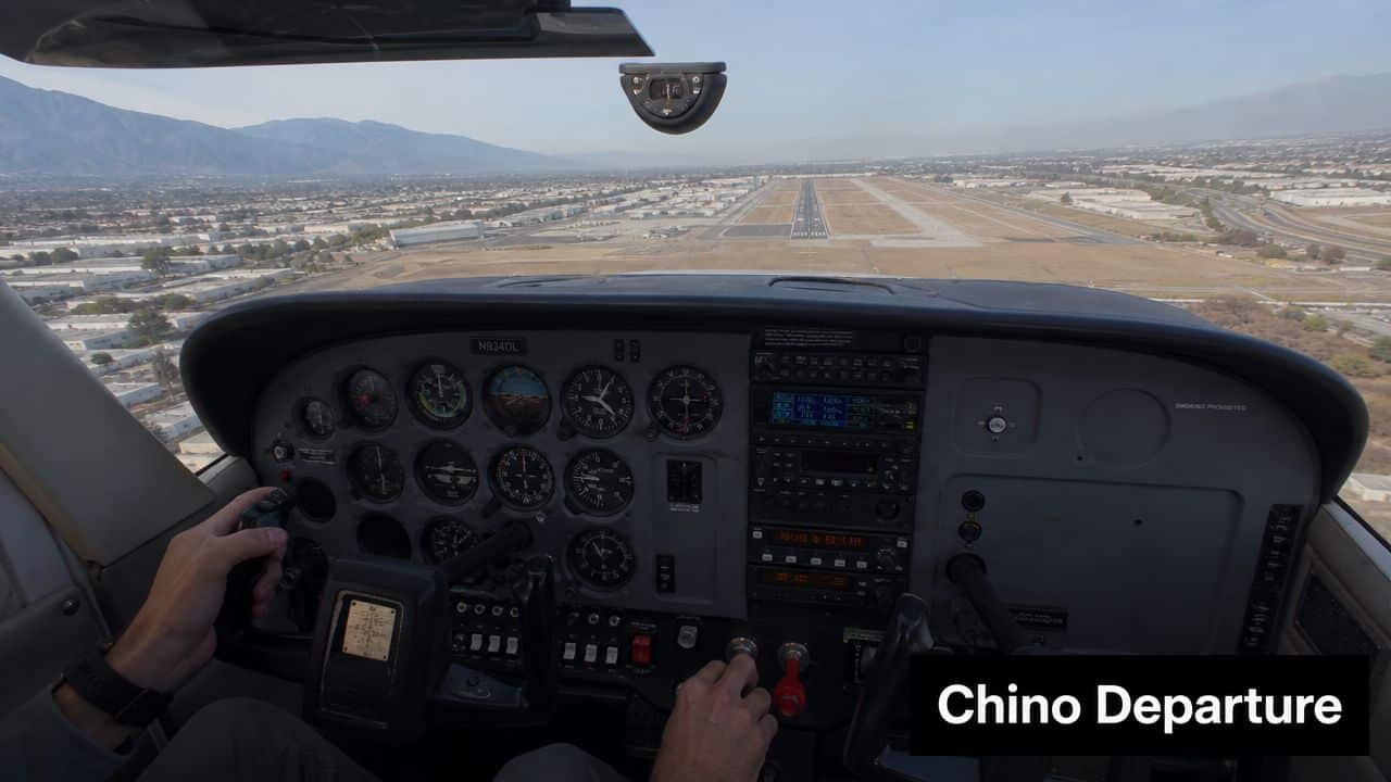
Leg one over developed areas
Right after departure, your attention is split between climb, traffic, radio work, and staying ahead of the airplane. Consequently, students often stop thinking strategically about altitude because they're busy doing other things.
Over a developed area, the practical question is not “am I above the ground enough?” It's “what is the highest obstacle around me, and am I high enough above that obstacle with the required horizontal logic in mind?” In a suburban environment, buildings and towers may drive the answer.
A smart pilot also asks a second question. If the engine fails after takeoff or on climb-out, where are the realistic landing options? That doesn't replace the legal minimum. It sharpens it.
Leg two over more open terrain
As the route moves over more open space, many pilots mentally relax and drop lower than they should. Open ground can feel forgiving from the cockpit, but wires, roads, vehicles, and isolated structures still matter.
In this regard, disciplined scanning helps. Don't just look at terrain elevation. Look for signs of what would make an emergency landing harder than it appears from above. Irrigation lines, uneven surfaces, and hidden obstructions don't announce themselves.
If the route gives you room, use the room. A legal minimum is a floor, not a target.
Leg three toward rising terrain
Now the route trends toward foothills. Here, terrain can rise faster than a student expects, especially if attention drifts toward checkpoints and radio calls.
For instrument flying, obstacle clearance concepts become more structured. MOCA provides 1,000 feet of obstacle clearance in non-mountainous areas and 2,000 feet in mountainous areas, but it only guarantees navigation signal reception within 22 nautical miles of the VOR according to this FAA charting summary on minimum altitudes. That's a perfect example of why one altitude can solve one problem but not another.
Even if you're flying VFR, that instrument concept teaches a useful lesson. Terrain clearance and navigation confidence are related, but they're not identical. When you launch from a busy place like Chino, training in that environment builds the habit of checking both, which is one reason many pilots value a Chino Airport flight school setting for early cross-country experience.
The planning method that works
Before the flight, break the route into segments based on what's below you:
- Built-up segment: Think obstacles and forced-landing consequences.
- Open segment: Think wires, vehicles, and false comfort.
- Rising terrain segment: Think terrain trend, obstacle margin, and whether your chosen altitude still gives you options.
That's how a pilot plans. Not by searching for one universal number, but by building answers leg by leg.
Common Errors and Instructor Tips
The biggest altitude mistakes usually don't come from ignorance. They come from oversimplification. A pilot remembers one rule, applies it everywhere, and stops evaluating what changed.
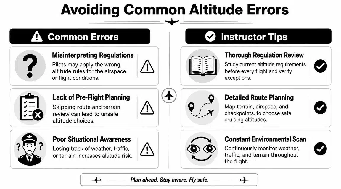
Error one confusing legal minimums with charted emergency altitudes
This is the classic trap. A pilot sees MSA on an approach chart and treats it like a normal cruising altitude for that whole area.
That's backward. A charted MSA is an emergency orientation tool within a defined area of an instrument approach. It is not your all-purpose answer, as explained in this overview of the difference between regulatory minimums and chart-based MSA.
Error two flying the magenta line instead of the terrain
GPS makes route following easy. It doesn't make obstacle evaluation automatic.
Students sometimes stare at course guidance and forget that the line on the screen doesn't guarantee suitable terrain below, especially if they're off their expected track or adapting around weather and traffic. The route on the display is not a terrain strategy.
Error three treating the minimum as the goal
A pilot who keeps asking “how low can I go?” often ends up with a brittle plan. There's no margin for downdrafts, distraction, reroutes, or bad luck.
Use these instructor habits instead:
- Pick an altitude with an out: Before takeoff, decide what extra height buys you in glide options and decision time.
- Review obstacles by segment: Don't plan one altitude for the whole trip if the environment changes.
- Look outside for landing reality: A field on the chart may not be a field you'd want in an actual engine-out.
- Re-evaluate in flight: Smoke, haze, sun angle, and traffic can change whether your original altitude still feels smart.
Error four borrowing helicopter logic for airplane decisions
Students sometimes hear that helicopters can operate lower and unconsciously import that flexibility into airplane thinking. That's a category mistake. Different aircraft have different capabilities, and the rules reflect that.
A helicopter exception doesn't give an airplane pilot permission to think like a helicopter pilot.
The better standard
The professional standard isn't “Can I defend this altitude after the flight?” It's “Would I still like this altitude if the engine quit right now?”
That question keeps your planning honest.
Your Altitude Is Your Responsibility
You are halfway home at the end of a long flight. The weather is still legal, the radios are busy, and the route you expected has already changed twice. That is when altitude stops being a memorized rule and becomes a judgment call. The pilot who treats altitude as a personal responsibility keeps options open. The pilot who treats it as a minimum to get away with starts running out of room.
That is the core lesson behind minimum safe altitude. The numbers in the regulation matter, and the charted altitudes matter, but neither one can look out the windshield for you. They do not know whether you are over rising terrain, boxed in by airspace, dealing with haze at dusk, or flying an airplane that is not climbing the way you hoped. You have to connect the legal floor, the charted guidance, and the situation you are in.
A good way to frame it is simple. Altitude buys time, distance, and choices. Time to run a checklist. Distance to glide toward a better landing area. Choices if weather, traffic, or a rough engine changes the plan.
That responsibility also follows the aircraft. As noted earlier, the rule allows helicopters more flexibility in some cases because they can operate differently from airplanes. The safety question does not change. Can this operation be conducted without creating a hazard to people or property below, and do you still have a workable set of options if conditions change?
Keep asking the question a careful instructor asks in flight: if the engine got quiet right now, or if ATC changed the route right now, would this altitude still give me a safe next move?
If the answer is no, climb.
If you want help building that kind of judgment in the cockpit, DuBois Aviation offers airplane and helicopter training at Chino Airport with one-on-one instruction, real-world airspace experience, and a safety-first approach that helps students turn regulations and chart symbols into practical decision-making.


