
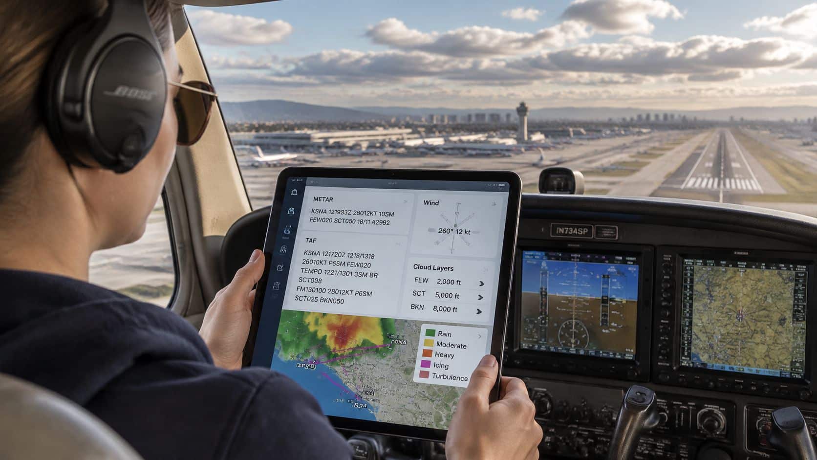
A cross-country lesson is coming up. The airport looks clear, but the briefing shows weather that could change before arrival. Reading aviation weather reports helps you build a picture of conditions at departure, along the route, and at the destination. Decode the reports first, then weigh their forecasts and uncertainty against your written personal minimums. A report is information for a flight decision, not the decision itself.
Table of Contents
- Which Report Answers the Weather Question
- How to Read Aviation Weather Reports From a METAR
- Read the TAF Time Blocks Before You Trust Them
- Add Area Forecasts AIRMETs and SIGMETs
- Turn the Codes Into a Go or Delay Call
- Practice the Briefing on a Real Lesson
- Aviation Weather Report Questions Pilots Still Ask
Which Report Answers the Weather Question
A cross-country briefing needs more than a snapshot at either airport. METARs and SPECIs report observed conditions at an airport; TAFs forecast expected conditions in a defined terminal area. Area forecasts, AIRMETs and SIGMETs help build the broader en-route picture.
| Product | Answers | Where it applies | How current |
|---|---|---|---|
| METAR | Observed airport weather | At the reporting station | Routine report, generally hourly |
| SPECI | A significant change since the last METAR | At the reporting station | Unscheduled; provides a newer observation |
| TAF | Expected terminal conditions | Within the airport's defined terminal forecast area | Scheduled issuance; check its explicit validity period |
| Graphical or area forecast | Broader clouds, weather and winds aloft picture | A region, not one runway | Use the current issuance and valid time on the chart |
| AIRMET | Moderate hazards important to light aircraft | Named areas along a route | Valid for the stated period; check for updates |
| SIGMET or convective SIGMET | Severe or convective hazards | Named areas or lines | Time-sensitive; check its coverage and valid period against the route |
The FAA Aeronautical Information Manual weather chapter says U.S. TAFs are normally issued at 0000Z, 0600Z, 1200Z and 1800Z. Most are valid for 24 hours, while some cover 30 hours. Check the stated validity period and any newer amendment before using a forecast.
Recognize What Each Report Covers
A report's usefulness depends on its place and time. A METAR describes conditions at its reporting station when observed. A TAF covers expected conditions within the airport's defined terminal forecast area during its validity period. Neither gives a complete picture of the weather between airports.
The United States uses an ICAO reporting format based on World Meteorological Organization guidance. The shared format helps pilots recognize reports across borders, while local units and conventions still require attention. U.S. visibility commonly appears in statute miles, and an altimeter group beginning with A uses inches of mercury. Other countries may use different visibility and pressure conventions.
Briefing habit: Label each item as observed, forecast or pilot-reported, then place it on the departure, en-route or arrival part of the flight. Use those reports to build the weather story, and compare it with forecast uncertainty and written personal minimums. Decoding a product helps you understand the conditions; it does not by itself make the flight decision.
How to Read Aviation Weather Reports From a METAR
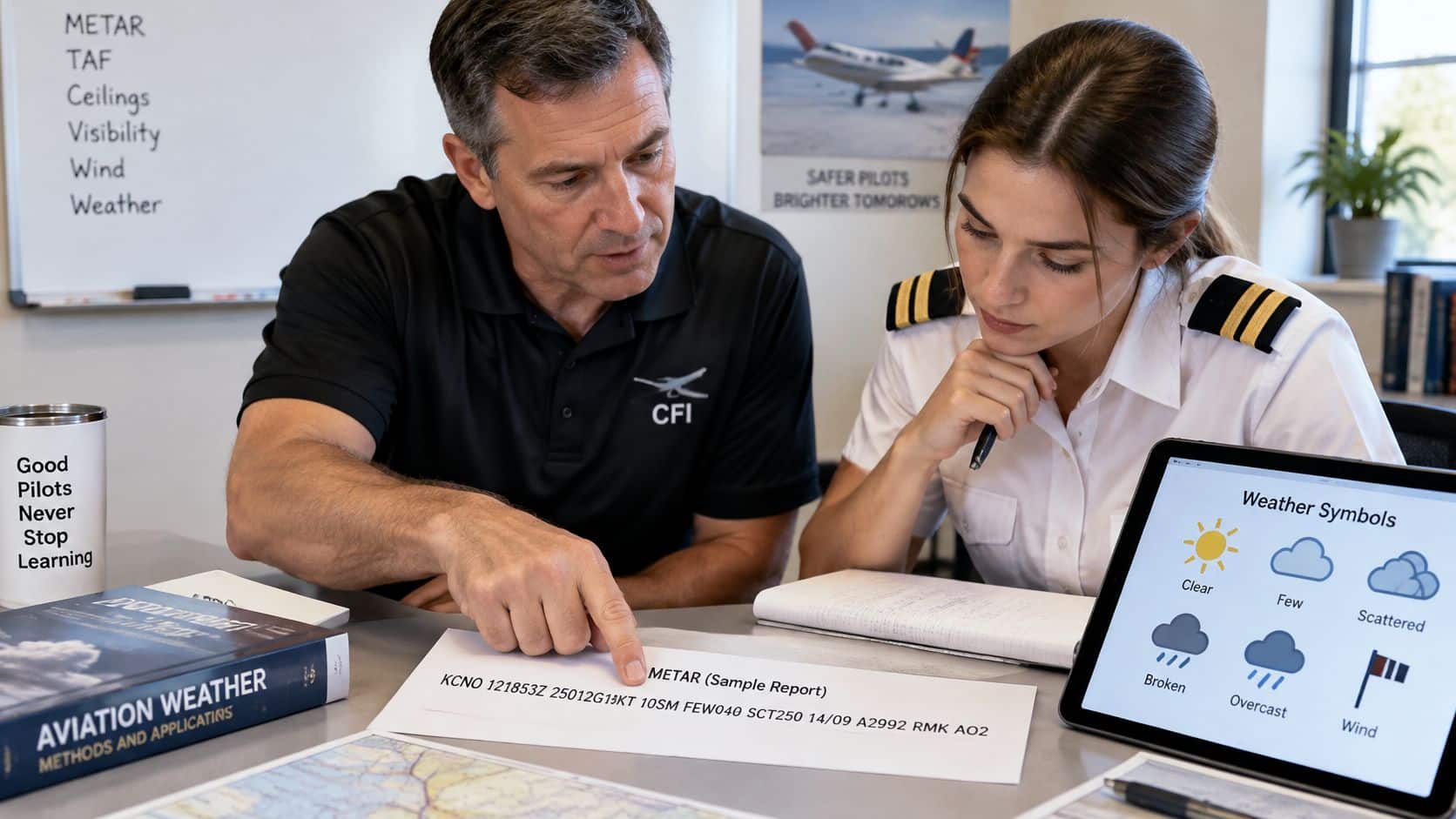
The following is a teaching example, not a live observation:
KCNO 121853Z 25012G18KT 10SM FEW040 SCT250 14/09 A2992 RMK AO2
Decode the Operational Groups
The FAA Balloon Flying Handbook weather chapter supports an operational reading order: verify station and time, assess wind and visibility, identify the ceiling, then compare observations with the applicable forecast. It also explains that P6SM means greater than 6 statute miles, not exactly that distance.
| Step | Sample group | Read it as | Don't assume |
|---|---|---|---|
| Station and time | KCNO 121853Z | Chino, 12th day at 1853 UTC | That an old report still matches the ramp |
| Wind | 25012G18KT | From 250 degrees true at 12 knots, gusting to 18 | That direction is magnetic or aligned with the runway |
| Visibility and weather | 10SM | Prevailing visibility 10 statute miles; no present-weather group appears | That visibility describes the entire route |
| Clouds | FEW040 SCT250 | Few clouds at 4,000 feet AGL; scattered at 25,000 feet AGL | That FEW or SCT is a ceiling |
| Temperature and dew point | 14/09 | Temperature 14°C; dew point 9°C | That the spread rules out fog or mist |
| Altimeter | A2992 | 29.92 inches of mercury | That this is a hectopascal QNH group |
These values belong only to the hypothetical report. The timestamp doesn't include a month or year, so the briefing source and current date must establish that context.
For wind, the useful question is the component relative to the intended runway. A pilot can use a crosswind chart or flight computer, but the wind direction and runway direction must first use a common true or magnetic reference. Gusts deserve their own comparison with aircraft limitations, school or rental policies, and personal minimums.
Find the Ceiling Before Assigning a Category
A ceiling is the lowest broken, overcast or vertical-visibility layer. Few and scattered layers don't establish one, so this sample reports no ceiling. That doesn't mean the sky is cloudless.
Cloud-layer heights are above ground level, not mean sea level. Confusing those references can produce a serious error when comparing clouds with terrain.
For flight-category interpretation, use the worse of ceiling or visibility:
| Category | Ceiling | Visibility |
|---|---|---|
| VFR | Above 3,000 feet | Above 5 statute miles |
| MVFR | 1,000 through 3,000 feet | 3 through 5 statute miles |
| IFR | 500 to below 1,000 feet | 1 to below 3 statute miles |
| LIFR | Below 500 feet | Below 1 statute mile |
These are weather-display categories, not a substitute for the applicable operating regulations. The sample falls in the VFR category, but that label alone doesn't establish legal cloud clearance, suitable terrain clearance or an acceptable training flight.
Finally, RMK introduces remarks. AO2 identifies an automated station with precipitation discrimination, not a promise that every relevant hazard was detected. Remarks and any newer SPECI still need review.
Read the TAF Time Blocks Before You Trust Them
A TAF must be matched to a clock, not read as a single forecast paragraph. The issuance time identifies when the forecast was prepared; the validity period identifies when its predictions apply.
This schematic uses invented conditions to teach the syntax. It combines change-group forms encountered internationally and isn't a claim that every forecasting authority uses every group.
TAF [station] 121100Z 1212/1312 24010KT P6SM BKN020
FM121800 26012KT P6SM BKN040
BECMG 1220/1222 SCT040
TEMPO 1304/1308 3SM BR BKN008
Match the Planned Flight to the Active Block
In this example, 1212/1312 means validity from the twelfth day at 1200 UTC through the thirteenth at 1200 UTC. The initial conditions apply until a subsequent change group modifies them.
FM121800 starts a new prevailing forecast at 1800 UTC on the twelfth. The BECMG window shows a gradual sky-condition change, while the TEMPO window identifies temporary reduced visibility and a lower ceiling during the following day.
| Group | Meaning | Use it for | Common miss |
|---|---|---|---|
| FM | From the stated time, a new prevailing condition | The forecast after that clock time | Keeping the old wind or ceiling past the FM time |
| BECMG | A gradual change during the stated window | Trend between prevailing conditions | Treating the change as instant at the first hour |
| TEMPO | Temporary fluctuations for less than half the period | A possible dip inside an otherwise better block | Calling it continuous weather or ignoring it |
| AMD | An amended TAF | Replacing the earlier issuance | Briefing from the original after an amendment |
An FM group replaces the prevailing conditions rather than merely adding an isolated weather element. TEMPO modifies the listed elements during its window; elements not changed remain governed by the applicable prevailing forecast.
The pilot should identify both departure and arrival blocks, including nearby deterioration that a delay could bring into the flight. An arrival close to a change boundary deserves more caution than an arrival comfortably inside a stable period.
Allow for Forecast Error
For FY2024 national IFR-and-below verification during the first six forecast hours, the NWS TAF verification report gives a Probability of Detection of 0.657, False Alarm Ratio of 0.359 and Critical Success Index of 0.48, against POD and FAR goals of 0.65 and 0.38. Under that verification definition, roughly two-thirds of qualifying events were detected, while roughly 36% of forecast-event cases were false alarms.
Those measures describe forecast performance, not an individual flight's odds of success. Results also differ among airports.
A forecast is a planning input, not a guarantee that conditions will remain on the favorable side of a personal minimum.
Compare the latest METAR or SPECI with the active forecast block. A ceiling lowering earlier than forecast, a wind shift arriving sooner or visibility failing to improve should prompt a reassessment, even when the original TAF looked comfortable.
Add Area Forecasts AIRMETs and SIGMETs
A favorable report at Chino Airport doesn't establish suitable conditions through the Cajon Pass, beneath coastal stratus or near developing buildups farther along a cross-country route. Those are different locations, often with different terrain and weather mechanisms.
A pilot needs a route picture, including the return route when that matters. Terminal forecasts generally don't provide turbulence or icing forecasts, so their silence about either hazard isn't an all-clear.
Examine the Space Between Airports
Graphical Forecasts for Aviation help connect airport conditions with broader cloud coverage, precipitation and winds. The useful approach is to examine the planned route at the planned time and altitude, rather than accepting the first chart displayed.
PIREPs add reports of what aircraft encountered. Their location, altitude, time and aircraft context matter: a smooth ride reported elsewhere or earlier doesn't establish a smooth ride along the proposed route.
A practical route review includes:
- Clouds and terrain: Compare cloud bases and tops with terrain, escape routes and the intended operating rules.
- Precipitation and convection: Check where weather is developing and where it may move during the flight.
- Winds and temperatures aloft: Assess groundspeed, fuel implications and the possibility of encountering freezing conditions.
- Observation gaps: Identify stretches where airport reports provide little direct information about the route.
Read Hazard Products as Route Decisions
AIRMET Sierra addresses IFR conditions and mountain obscuration. AIRMET Tango addresses turbulence and strong surface winds. AIRMET Zulu addresses icing and freezing-level information. A moderate hazard can still exceed the capability of a light trainer or the experience of its pilot.
A SIGMET addresses more severe non-convective hazards. A convective SIGMET addresses qualifying thunderstorm activity, including lines, embedded storms or widespread convection. Neither should be reduced to a symbol that happens to appear near a route line.
For each advisory, establish the affected location, movement, stated vertical extent and valid time. Then determine whether the aircraft's route or altitude enters the affected area and whether a suitable alternative exists.
The practical review of icing conditions should include aircraft capability and an avoidance plan, not merely whether ice appears likely at the departure airport. A change in altitude isn't automatically a safe solution when terrain, cloud layers or other hazards constrain the choices.
Use current government aviation-weather displays and the current AIM weather guidance rather than a saved screenshot. A screenshot can preserve a chart's appearance while hiding the fact that a newer issuance or advisory has replaced it.
Route check: An acceptable departure and destination don't compensate for an unacceptable segment between them.
A complete briefing combines airport products with route hazards, pilot reports and broader weather information. An airport observation alone isn't a complete preflight weather review.
Turn the Codes Into a Go or Delay Call
Consider a hypothetical training flight departing KCNO, crossing higher terrain and arriving where marine-layer ceilings are possible. The pilot records a suitable alternate before departure and evaluates the route as well as both airports. If any phase exceeds a written minimum, the plan needs to change before the flight begins.

The FAA's AC 91-92 preflight briefing guidance.pdf) recommends reviewing departure, en-route and arrival weather together with observations, forecasts, PIREPs, radar, satellite imagery and hazard advisories. Its risk-management approach supports building a weather story rather than collecting disconnected reports.
Departure, En-Route and Arrival Weather Worksheet
| Phase | Record | Compare | Decide |
|---|---|---|---|
| Departure at KCNO | Ceiling, visibility, wind and crosswind, trend | Latest METAR or SPECI against the active TAF block | Go, delay or change runway |
| En route | AIRMET or SIGMET areas, PIREPs, planned altitude | Whether planned altitude and route enter the area | Reroute, change altitude or wait |
| Destination | Ceiling, visibility, wind, TAF trend | Destination conditions against written minimums | Go, delay or divert |
| Alternate | Same elements as destination | Whether the alternate meets planned minimums | Confirm or select another |
The worksheet should distinguish observations from forecasts. It should also include the time each condition applies, because a suitable alternate now may not remain suitable when needed.
Apply Perceive, Process, Perform
- Perceive the change: Identify what differs from the earlier briefing, such as an unexpected ceiling reduction or increasing gusts.
- Process the consequence: Connect that change to runway use, terrain clearance, fuel, aircraft performance and escape options.
- Perform an action: Delay, reroute, change altitude where appropriate, select another alternate or cancel.
Personal minimums should be written before schedule pressure or passenger expectations enter the discussion. Useful categories include wind, turbulence, density altitude, terrain and runway length or condition.
These are recommendations, not regulations. The preflight responsibilities in 14 CFR 91.103 remain separate from a school worksheet or personal risk limit; pilots should consult the current regulation for the requirements applicable to the intended operation. Likewise, a renter's operating agreement or aircraft limitation isn't interchangeable with a personal minimum.
A structured set of go/no-go criteria helps identify the specific condition that would change the decision. A vague intention to remain cautious doesn't provide the same decision point.
Avoid the Fog-Code Trap
The FAA Aviation Weather Handbook states that visibility must be less than 5/8 statute mile for fog to be included in a TAF as FG; related forms include FZFG for freezing fog and MIFG for shallow fog. That coding threshold isn't an operating minimum.
The absence of FG doesn't establish that visibility, mist or low cloud won't affect the operation. The pilot still needs to evaluate the whole forecast and its trend.
The final decision check should catch these mistakes:
- An outdated go decision: A newer SPECI arrives, but nobody reassesses the departure.
- An undefined marginal call: The pilot accepts deteriorating conditions without a written threshold.
- A missing route assessment: The destination looks favorable, so the en-route worksheet remains blank.
Practice the Briefing on a Real Lesson
Before a lesson, the student can save a current METAR, TAF and route-hazard briefing, then explain what each means for the planned flight. The instructor can ask the student to identify the runway-relative crosswind, the active TAF time block and the condition that would trigger a delay. The goal is to connect each decoded product to a specific part of the flight, not to treat the report as a go/no-go decision by itself.
Practice Exercises With Answers
- Find the lowest broken layer: In the hypothetical report
KABC 121853Z 25012G18KT 10SM BKN025 OVC080 14/09 A2992, the lowest broken layer is at 2,500 feet. - Visibility interpretation:
P6SMmeans greater than six statute miles, not exactly six. - Category assignment: In a hypothetical report showing
BKN008and2SM, the category is IFR. The broken ceiling is 800 feet and visibility is two statute miles.
Use the exercise to prepare for a cross-country flight, instrument training or a rental checkout. With current products, compare the departure, route and arrival picture, then consider how forecast uncertainty and written personal minimums affect the plan.
Match the Briefing to the Aircraft
At a busy towered training airport such as Chino, students can connect weather decisions with runway selection, radio work and pattern planning. For practice elsewhere, choose a nearby non-towered airport as the destination and assess how its reported weather and the route conditions fit the same lesson plan.
Private-pilot students, instrument candidates and renters should match the briefing to the actual aircraft's performance and limitations. A weather code describes reported conditions; it does not set a personal minimum or make the flight decision.
Aviation Weather Report Questions Pilots Still Ask
What Is the Difference Between a Ceiling and a Cloud Base?
A cloud base is the bottom of a cloud layer; a ceiling is the lowest broken, overcast, or vertical-visibility layer reported. FEW and SCT layers have cloud bases but do not count as ceilings.
When Is a TAF Needed for an Alternate?
For IFR flight planning, 14 CFR 91.169 sets the alternate-airport requirements and forecast-weather provisions. Use the regulation and applicable procedure notes to determine whether an airport qualifies.
A TAF is one part of that assessment. Check the forecast conditions against the available approaches, aircraft capability, and applicable restrictions before selecting an alternate.
What if the METAR Is Hours Old?
Treat an hours-old METAR as an observation of past conditions, not current airport weather. Look for a newer routine report or SPECI. If reporting is unavailable, account for that gap before relying on the airport for departure or arrival.
Do PIREPs Matter for a Local Training Flight?
Yes. A nearby PIREP can report turbulence, icing, or cloud conditions that a surface station cannot observe. Check its age, location, and altitude to judge how closely it applies to the route and lesson. No PIREP means only that no report is available, not that hazards are absent.
Where Should a U.S. Pilot Get a Complete Briefing?
Use an FAA-approved weather briefing service, such as the FAA's Flight Service briefing tools, to review observations, forecasts, route hazards, and other applicable preflight information. Government aviation-weather products can help cross-check conditions.
A briefing gathers information; the pilot still has to assess what it means for the flight. Identify unsuitable conditions, uncertainty, and practical alternatives before making a departure decision.
DuBois Aviation offers flight instruction and aircraft rental at Chino Airport, where weather interpretation can be practiced alongside aircraft performance and runway decisions. Visit DuBois Aviation to request training information or ask about scheduling a school tour and discussing a practical weather briefing with a CFI.